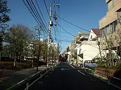
Suidō
水道 | |
|---|---|
District | |
 | |
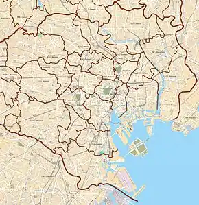 Suidō Location of Suidō within Tokyo | |
| Coordinates: 35°42′34.41″N 139°44′16.93″E / 35.7095583°N 139.7380361°E | |
| Country | Japan |
| Region | Kantō |
| Prefecture | Tokyo |
| Ward | Bunkyō |
| Area | |
| • Total | 0.193 km2 (0.075 sq mi) |
| Population (August 1, 2019)[2] | |
| • Total | 6,548 |
| Time zone | UTC+9 (JST) |
| Zip code | 112-0005 |
| Area code | 03 |
Education
Bunkyo Board of Education operates the local public elementary and middle schools.
Zoned elementary schools for parts of Suidō are: Kanatomi (金富小学校) and Kohinatadaimachi (小日向台町小学校).[3]
Zoned junior high schools for parts of Suidō are: No. 3 (第三中学校), Meidai (茗台中学校), and Otowa (音羽中学校).[4]
References
- ↑ "文京の統計 - 第51回文京の統計(平成30年)". 文京区. 2019-01-01. Retrieved 2019-09-01.
- ↑ "文京区人口統計資料 - 町丁別世帯・人口(住民基本台帳)(毎月1日現在)". 文京区. 2019-08-01. Retrieved 2019-09-01.
- ↑ "小学校 通学区域". City of Bunkyo. Retrieved 2022-10-09.
- ↑ "中学校 通学区域". City of Bunkyo. Retrieved 2022-10-09.
External links
| Districts |
|  | ||||
|---|---|---|---|---|---|---|
| Education | ||||||
| Major stations |
| |||||
| Landmarks | ||||||
This article is issued from Wikipedia. The text is licensed under Creative Commons - Attribution - Sharealike. Additional terms may apply for the media files.