Suc-et-Sentenac | |
|---|---|
Part of Val-de-Sos | |
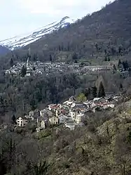 A general view of Suc-et-Sentenac | |
Location of Suc-et-Sentenac | |
 Suc-et-Sentenac 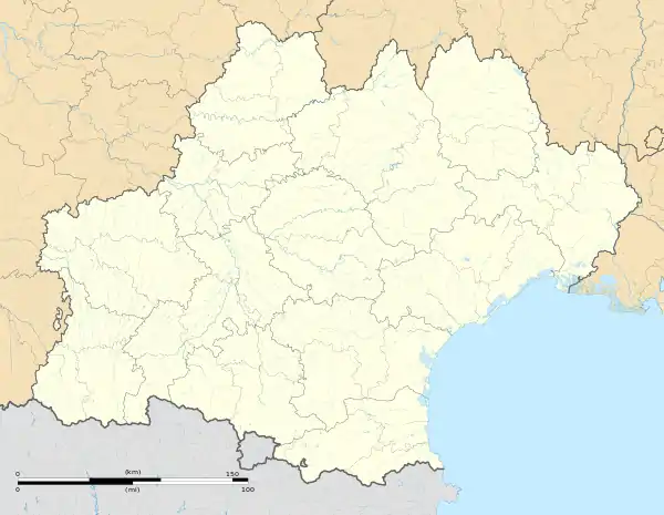 Suc-et-Sentenac | |
| Coordinates: 42°47′00″N 1°28′36″E / 42.7833°N 1.4767°E | |
| Country | France |
| Region | Occitania |
| Department | Ariège |
| Arrondissement | Foix |
| Canton | Sabarthès |
| Commune | Val-de-Sos |
| Area 1 | 31.69 km2 (12.24 sq mi) |
| Population (2019)[1] | 55 |
| • Density | 1.7/km2 (4.5/sq mi) |
| Time zone | UTC+01:00 (CET) |
| • Summer (DST) | UTC+02:00 (CEST) |
| Postal code | 09220 |
| Elevation | 752–2,196 m (2,467–7,205 ft) (avg. 1,000 m or 3,300 ft) |
| 1 French Land Register data, which excludes lakes, ponds, glaciers > 1 km2 (0.386 sq mi or 247 acres) and river estuaries. | |
Suc-et-Sentenac (French pronunciation: [syk e sɛ̃tnak]; Occitan: Suc e Sentenac) is a former commune in the Ariège department in southwestern France. On 1 January 2019, it was merged into the new commune Val-de-Sos.[2]
Population
Inhabitants of Suc-et-Sentenac are called Sucatels.
| Year | Pop. | ±% |
|---|---|---|
| 1962 | 51 | — |
| 1968 | 100 | +96.1% |
| 1975 | 89 | −11.0% |
| 1982 | 84 | −5.6% |
| 1990 | 66 | −21.4% |
| 1999 | 103 | +56.1% |
| 2008 | 60 | −41.7% |
See also
References
- ↑ Téléchargement du fichier d'ensemble des populations légales en 2019, INSEE
- ↑ Arrêté préfectoral 16 July 2018, p. 160 (in French)
Wikimedia Commons has media related to Suc-et-Sentenac.
This article is issued from Wikipedia. The text is licensed under Creative Commons - Attribution - Sharealike. Additional terms may apply for the media files.