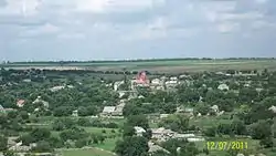
Styla
Стила | |
|---|---|
 | |
 Coat of arms | |
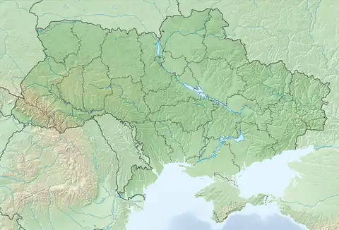 Styla Location of Styla within Ukraine  Styla Styla (Donetsk Oblast) | |
| Coordinates: 47°41′37″N 37°50′15″E / 47.69361°N 37.83750°E | |
| Country | Ukraine |
| Province | Donetsk Oblast |
| District | Starobesheve Raion |
| Founded | 1780 |
| Elevation | 114 m (374 ft) |
| Population | |
| • Total | 2,198 |
| Time zone | UTC+2 (EET) |
| • Summer (DST) | UTC+3 (EEST) |
| Postal code | 87221 |
| Area code | +380 6253 |
Styla (Ukrainian: Стила; Russian: Стыла) is a village in Starobesheve Raion (district) in Donetsk Oblast of eastern Ukraine, at 46.9 km south from the centre of Donetsk city.
Pro-Russian forces took the village under their control during the Russo-Ukrainian War.
Demographics
Native language as of the Ukrainian Census of 2001:[1]
- Ukrainian 3.23%
- Russian 87.49%
- Greek 8.96%
- Belarusian 0.23%
- Moldavian 0.05%
References
- 1 2 "Офіційна сторінка Всеукраїнського перепису населення | Банк даних" [All-Ukrainian population census | Database]. ukrcensus.gov.ua (in Ukrainian). Retrieved 5 June 2023.
External links
Media Coverage of the War in Donbas
- Styla, search results on string "Styla" in Information Resistance.
This article is issued from Wikipedia. The text is licensed under Creative Commons - Attribution - Sharealike. Additional terms may apply for the media files.