| Stoney Indian Lake | |
|---|---|
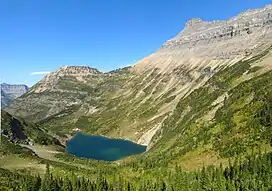 View of Stoney Indian Lake from Stoney Indian Pass | |
 Stoney Indian Lake  Stoney Indian Lake | |
| Location | Glacier National Park, Glacier County, Montana, US |
| Coordinates | 48°53′10″N 113°51′58″W / 48.88611°N 113.86611°W[1] |
| Type | Natural |
| Primary outflows | Pass Creek |
| Basin countries | United States |
| Max. length | .20 mi (0.32 km) |
| Max. width | .15 mi (0.24 km) |
| Surface elevation | 6,325 ft (1,928 m) |
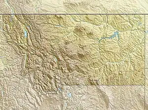
Stoney Indian Lake is located in Glacier National Park in the U. S. state of Montana. It is northeast of Wahcheechee Mountain and south of Stoney Indian Peaks.[2]
See also
References
- ↑ "Stoney Indian Lake". Geographic Names Information System. United States Geological Survey, United States Department of the Interior. Retrieved 5 February 2011.
- ↑ "Mount Cleveland, MT" (Map (USGS Quad)). TopoQuest. Retrieved 5 February 2011.
This article is issued from Wikipedia. The text is licensed under Creative Commons - Attribution - Sharealike. Additional terms may apply for the media files.