Slatinka nad Bebravou | |
|---|---|
Municipality | |
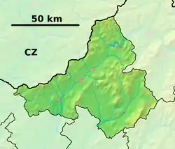 Slatinka nad Bebravou Location of Slatinka nad Bebravou in the Trenčín Region 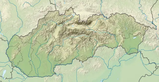 Slatinka nad Bebravou Slatinka nad Bebravou (Slovakia) | |
| Coordinates: 48°51′N 18°15′E / 48.850°N 18.250°E | |
| Country | Slovakia |
| Region | Trenčín |
| District | Bánovce nad Bebravou |
| First mentioned | 1332 |
| Area | |
| • Total | 9.53[1] km2 (3.68[1] sq mi) |
| Elevation | 285[2] m (935[2] ft) |
| Population (2021) | |
| • Total | 194[3] |
| Postal code | 956 53[2] |
| Area code | +421 38[2] |
| Car plate | BN |
| Website | slatinkanb.sk |
Slatinka nad Bebravou (Hungarian: Alsószalatna) is a village and municipality in Bánovce nad Bebravou District in the Trenčín Region of north-western Slovakia.
History
In historical records the village was first mentioned in 1332.
Geography
The municipality lies at an altitude of 275 metres and covers an area of 11.527 km². It has a population of about 507 people.
References
- 1 2 "Hustota obyvateľstva - obce [om7014rr_ukaz: Rozloha (Štvorcový meter)]". www.statistics.sk (in Slovak). Statistical Office of the Slovak Republic. 2022-03-31. Retrieved 2022-03-31.
- 1 2 3 4 "Základná charakteristika". www.statistics.sk (in Slovak). Statistical Office of the Slovak Republic. 2015-04-17. Retrieved 2022-03-31.
- ↑ "Počet obyvateľov podľa pohlavia - obce (ročne)". www.statistics.sk (in Slovak). Statistical Office of the Slovak Republic. 2022-03-31. Retrieved 2022-03-31.
External links
- Official page
- https://web.archive.org/web/20070513023228/http://www.statistics.sk/mosmis/eng/run.html
This article is issued from Wikipedia. The text is licensed under Creative Commons - Attribution - Sharealike. Additional terms may apply for the media files.