Sint-Gillis-Waas | |
|---|---|
 | |
 Flag  Coat of arms | |
Location of Sint-Gillis-Waas | |
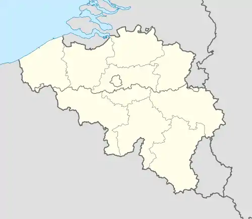 Sint-Gillis-Waas Location in Belgium
Location of Sint-Gillis-Waas in East Flanders 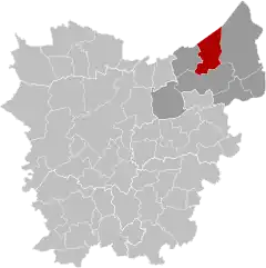 | |
| Coordinates: 51°13′N 04°07′E / 51.217°N 4.117°E | |
| Country | |
| Community | Flemish Community |
| Region | Flemish Region |
| Province | East Flanders |
| Arrondissement | Sint-Niklaas |
| Government | |
| • Mayor | Maaike De Ridder (CD&V) |
| • Governing party/ies | CD&V, Groen-Vooruit |
| Area | |
| • Total | 55.49 km2 (21.42 sq mi) |
| Population (2018-01-01)[1] | |
| • Total | 19,273 |
| • Density | 350/km2 (900/sq mi) |
| Postal codes | 9170 |
| NIS code | 46020 |
| Area codes | 03 |
| Website | www.sint-gillis-waas.be |
Sint-Gillis-Waas (Dutch pronunciation: [sɪnt ˌxɪlɪs ˈʋaːs];[2] French: Saint-Gilles-Waes) is a municipality located in the Belgian province of East Flanders. The municipality comprises the towns of De Klinge, Meerdonk, Sint-Gillis-Waas proper and Sint-Pauwels. On 1 January 2018, Sint-Gillis-Waas had a total population of 19,273. The total area is 54.98 km² which gives a population density of 357 inhabitants per km².
References
- ↑ "Wettelijke Bevolking per gemeente op 1 januari 2018". Statbel. Retrieved 9 March 2019.
- ↑ Every word in isolation: [sɪnt ˌɣɪlɪs ˈʋaːs].
External links
 Media related to Sint-Gillis-Waas at Wikimedia Commons
- Official website (in Dutch)
| Aalst |  | |
|---|---|---|
| Dendermonde | ||
| Eeklo | ||
| Ghent | ||
| Oudenaarde | ||
| Sint-Niklaas | ||
| ||
This article is issued from Wikipedia. The text is licensed under Creative Commons - Attribution - Sharealike. Additional terms may apply for the media files.