| Sherrick Run Tributary to Jacobs Creek | |
|---|---|
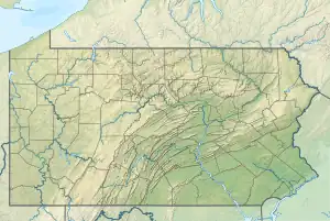 Location of Sherrick Run mouth  Sherrick Run (Jacobs Creek tributary) (the United States) | |
| Location | |
| Country | United States |
| State | Pennsylvania |
| County | Westmoreland |
| Borough | Mount Pleasant |
| Physical characteristics | |
| Source | Wilson Run divide |
| • location | pond about 1 mile northwest of Mount Pleasant, Pennsylvania[1] |
| • coordinates | 40°10′12″N 079°33′47″W / 40.17000°N 79.56306°W[2] |
| • elevation | 1,160 ft (350 m)[1] |
| Mouth | Jacobs Creek |
• location | Iron Bridge, Pennsylvania[3] |
• coordinates | 40°06′45″N 079°33′47″W / 40.11250°N 79.56306°W[2] |
• elevation | 1,027 ft (313 m)[3] |
| Length | 4.31 mi (6.94 km)[4] |
| Basin size | 4.89 square miles (12.7 km2)[5] |
| Discharge | |
| • location | Jacobs Creek |
| • average | 6.98 cu ft/s (0.198 m3/s) at mouth with Jacobs Creek[5] |
| Basin features | |
| Progression | generally south[4] |
| River system | Monongahela River |
| Tributaries | |
| • left | unnamed tributaries |
| • right | unnamed tributaries |
| Bridges | Old 119, US 119, Kings Pointe Road, PA 31, Valley Kitchen Road, PA 981, S Quarry Street, Smouse Road (x2), PA 819, US 119 |
Sherrick Run is a 4.31 mi (6.94 km) long 1st order tributary to Jacobs Creek in Westmoreland County, Pennsylvania.
Course
Sherrick Run rises in a pond about 1 mile northwest of Mount Pleasant, Pennsylvania,[1] and then flows south to join Jacobs Creek at Iron Bridge.[3]
Watershed
Sherrick Run drains 4.89 square miles (12.7 km2) of area, receives about 42.3 in/year of precipitation, has a wetness index of 388.72, and is about 17% forested.[5]
References
- 1 2 3 "Get Maps". USGS Topoview. US Geological Survey. Retrieved 19 November 2020.
- 1 2 "GNIS Detail - Sherrick Run". geonames.usgs.gov. US Geological Survey. Retrieved 19 November 2020.
- 1 2 3 "Get Maps". USGS Topoview. US Geological Survey. Retrieved 19 November 2020.
- 1 2 "ArcGIS Web Application". epa.maps.arcgis.com. US EPA. Retrieved 19 November 2020.
- 1 2 3 "Sherrick Run Watershed Report". US EPA Geoviewer. US EPA. Retrieved 19 November 2020.
This article is issued from Wikipedia. The text is licensed under Creative Commons - Attribution - Sharealike. Additional terms may apply for the media files.