Sankt Peter-Freienstein | |
|---|---|
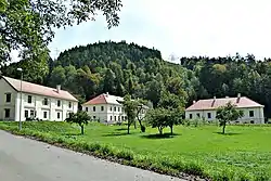 Freienstein Castle | |
 Sankt Peter-Freienstein Location within Austria | |
| Coordinates: 47°24′37″N 15°01′45″E / 47.41028°N 15.02917°E | |
| Country | Austria |
| State | Styria |
| District | Leoben |
| Government | |
| • Mayor | Anita Weinkogl (SPÖ) |
| Area | |
| • Total | 27.33 km2 (10.55 sq mi) |
| Elevation | 600 m (2,000 ft) |
| Population (2018-01-01)[2] | |
| • Total | 2,383 |
| • Density | 87/km2 (230/sq mi) |
| Time zone | UTC+1 (CET) |
| • Summer (DST) | UTC+2 (CEST) |
| Postal code | 8792 |
| Area code | 03842 |
| Vehicle registration | LN |
| Website | www.st-peter-freienstein. gv.at |
Sankt Peter-Freienstein is a municipality in the district of Leoben in Austrian state of Styria.
Geography
The municipality lies on the southeast edge of the Eisenerz Alps the Vordernberger valley.
References
- ↑ "Dauersiedlungsraum der Gemeinden Politischen Bezirke und Bundesländer - Gebietsstand 1.1.2018". Statistics Austria. Retrieved 10 March 2019.
- ↑ "Einwohnerzahl 1.1.2018 nach Gemeinden mit Status, Gebietsstand 1.1.2018". Statistics Austria. Retrieved 9 March 2019.
This article is issued from Wikipedia. The text is licensed under Creative Commons - Attribution - Sharealike. Additional terms may apply for the media files.