Sandytown, Indiana | |
|---|---|
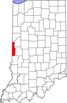 Vermillion County's location in Indiana | |
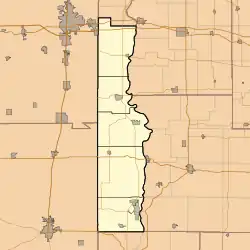 Sandytown Sandytown's location in Vermillion County | |
| Coordinates: 39°40′55″N 87°26′46″W / 39.68194°N 87.44611°W | |
| Country | United States |
| State | Indiana |
| County | Vermillion |
| Township | Clinton |
| Elevation | 600 ft (183 m) |
| Time zone | UTC-5 (Eastern (EST)) |
| • Summer (DST) | UTC-4 (EDT) |
| ZIP code | 47842 |
| Area code | 765 |
| GNIS feature ID | 443014 |
Sandytown is an unincorporated community in Clinton Township, Vermillion County, in the U.S. state of Indiana.[2]
History
Sandytown began as a mining community.[3] The community received its name on account of the sandy character of its soil.[4]
Geography
Sandytown is located at 39°40′55″N 87°26′46″W / 39.68194°N 87.44611°W.
References
- ↑ "US Board on Geographic Names". United States Geological Survey. October 25, 2007. Retrieved July 15, 2016.
- ↑ "Sandytown, Indiana". Geographic Names Information System. United States Geological Survey. Retrieved August 1, 2017.
- ↑ Vermillion County Historical Society (Vermillion County, Ind.) (1990). Vermillion County, Indiana History and Families. Turner Publishing Company. p. 84. ISBN 978-0-938021-34-6.
- ↑ Baker, Ronald L. (October 1995). From Needmore to Prosperity: Hoosier Place Names in Folklore and History. Indiana University Press. p. 294. ISBN 978-0-253-32866-3.
This village was named for extremely sandy soil...
Municipalities and communities of Vermillion County, Indiana, United States | ||
|---|---|---|
| City | Map of Indiana highlighting Vermillion County | |
| Towns | ||
| Townships | ||
| CDPs | ||
| Other communities | ||
| Ghost towns | ||
| Footnotes | ‡This populated place also has portions in an adjacent county or counties | |
This article is issued from Wikipedia. The text is licensed under Creative Commons - Attribution - Sharealike. Additional terms may apply for the media files.