Sain-Bel | |
|---|---|
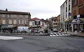 The centre of Sain-Bel | |
.svg.png.webp) Coat of arms | |
Location of Sain-Bel | |
 Sain-Bel  Sain-Bel | |
| Coordinates: 45°48′39″N 4°35′55″E / 45.8108°N 4.5986°E | |
| Country | France |
| Region | Auvergne-Rhône-Alpes |
| Department | Rhône |
| Arrondissement | Villefranche-sur-Saône |
| Canton | L'Arbresle |
| Government | |
| • Mayor (2020–2026) | Raymond Revellin-Clerc[1] |
| Area 1 | 3.68 km2 (1.42 sq mi) |
| Population | 2,501 |
| • Density | 680/km2 (1,800/sq mi) |
| Time zone | UTC+01:00 (CET) |
| • Summer (DST) | UTC+02:00 (CEST) |
| INSEE/Postal code | 69171 /69210 |
| Elevation | 228–351 m (748–1,152 ft) (avg. 240 m or 790 ft) |
| 1 French Land Register data, which excludes lakes, ponds, glaciers > 1 km2 (0.386 sq mi or 247 acres) and river estuaries. | |
Sain-Bel (French pronunciation: [sɛ̃ bɛl]) is a commune in the Rhône department in eastern France.
Population
| Year | Pop. | ±% p.a. |
|---|---|---|
| 1968 | 1,798 | — |
| 1975 | 1,605 | −1.61% |
| 1982 | 1,761 | +1.33% |
| 1990 | 1,892 | +0.90% |
| 1999 | 1,919 | +0.16% |
| 2007 | 2,153 | +1.45% |
| 2012 | 2,271 | +1.07% |
| 2017 | 2,316 | +0.39% |
| Source: INSEE[3] | ||
See also
References
- ↑ "Répertoire national des élus: les maires" (in French). data.gouv.fr, Plateforme ouverte des données publiques françaises. 13 September 2022.
- ↑ "Populations légales 2021". The National Institute of Statistics and Economic Studies. 28 December 2023.
- ↑ Population en historique depuis 1968, INSEE
Wikimedia Commons has media related to Sain-Bel.
This article is issued from Wikipedia. The text is licensed under Creative Commons - Attribution - Sharealike. Additional terms may apply for the media files.