Rosureux | |
|---|---|
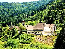 A general view of Rosureux | |
Location of Rosureux | |
 Rosureux 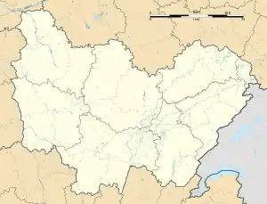 Rosureux | |
| Coordinates: 47°13′08″N 6°41′16″E / 47.2189°N 6.6878°E | |
| Country | France |
| Region | Bourgogne-Franche-Comté |
| Department | Doubs |
| Arrondissement | Pontarlier |
| Canton | Valdahon |
| Government | |
| • Mayor (2020–2026) | Jerome Boillon[1] |
| Area 1 | 6.14 km2 (2.37 sq mi) |
| Population | 80 |
| • Density | 13/km2 (34/sq mi) |
| Time zone | UTC+01:00 (CET) |
| • Summer (DST) | UTC+02:00 (CEST) |
| INSEE/Postal code | 25504 /25380 |
| Elevation | 428–972 m (1,404–3,189 ft) |
| 1 French Land Register data, which excludes lakes, ponds, glaciers > 1 km2 (0.386 sq mi or 247 acres) and river estuaries. | |
Rosureux (French pronunciation: [ʁozyʁø]) is a commune in the Doubs department in the Bourgogne-Franche-Comté region in eastern France.
Geography
Rosureux lies 26 km (16 mi) from Le Russey on the banks of the Dessoubre.
Population
| Year | Pop. | ±% |
|---|---|---|
| 1962 | 109 | — |
| 1968 | 117 | +7.3% |
| 1975 | 81 | −30.8% |
| 1982 | 82 | +1.2% |
| 1990 | 102 | +24.4% |
| 1999 | 81 | −20.6% |
| 2008 | 90 | +11.1% |
| 2012 | 79 | −12.2% |
See also
References
- ↑ "Répertoire national des élus: les maires". data.gouv.fr, Plateforme ouverte des données publiques françaises (in French). 9 August 2021.
- ↑ "Populations légales 2021". The National Institute of Statistics and Economic Studies. 28 December 2023.
External links
Wikimedia Commons has media related to Rosureux.
- Rosureux on the regional Web site (in French)
This article is issued from Wikipedia. The text is licensed under Creative Commons - Attribution - Sharealike. Additional terms may apply for the media files.