Rigny-sur-Arroux | |
|---|---|
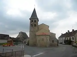 The church in Rigny-sur-Arroux | |
Location of Rigny-sur-Arroux | |
 Rigny-sur-Arroux 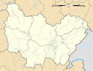 Rigny-sur-Arroux | |
| Coordinates: 46°32′00″N 4°01′43″E / 46.5333°N 4.0286°E | |
| Country | France |
| Region | Bourgogne-Franche-Comté |
| Department | Saône-et-Loire |
| Arrondissement | Charolles |
| Canton | Gueugnon |
| Government | |
| • Mayor (2020–2026) | Patrice Bernard[1] |
| Area 1 | 48.17 km2 (18.60 sq mi) |
| Population | 619 |
| • Density | 13/km2 (33/sq mi) |
| Time zone | UTC+01:00 (CET) |
| • Summer (DST) | UTC+02:00 (CEST) |
| INSEE/Postal code | 71370 /71160 |
| Elevation | 227–347 m (745–1,138 ft) (avg. 240 m or 790 ft) |
| 1 French Land Register data, which excludes lakes, ponds, glaciers > 1 km2 (0.386 sq mi or 247 acres) and river estuaries. | |
Rigny-sur-Arroux (French pronunciation: [ʁiɲi syʁ aʁu], literally Rigny on Arroux) is a commune in the east-central French department of Saône-et-Loire, Bourgogne-Franche-Comté.
The discovery in 1874 of a cache of Solutrean laurel-leaf flint points in the hamlet of Volgu, just south of the village proper, indicates that the environs of the present-day Rigny were inhabited or frequented by Paleolithic peoples around 20,000 years ago.[3]
See also
References
- ↑ "Répertoire national des élus: les maires" (in French). data.gouv.fr, Plateforme ouverte des données publiques françaises. 13 September 2022.
- ↑ "Populations légales 2021". The National Institute of Statistics and Economic Studies. 28 December 2023.
- ↑ Schmidt P; Bellot-Gurlet L; Floss H (27 July 2018). "The unique Solutrean laurel-leaf points of Volgu:heat-treated or not?". Antiquity. Antiquity Publications/Cambridge University Press. 92 (363): 587–602. doi:10.15184/aqy.2018.87. Retrieved 9 July 2021.
Wikimedia Commons has media related to Rigny-sur-Arroux.
This article is issued from Wikipedia. The text is licensed under Creative Commons - Attribution - Sharealike. Additional terms may apply for the media files.