Redpath
| |
|---|---|
.jpg.webp) Village entrance | |
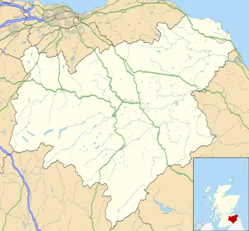 Redpath Location within the Scottish Borders | |
| Population | 56 (2001)[1] |
| OS grid reference | NT583357 |
| • Edinburgh | 31 mi (50 km) NW |
| Civil parish |
|
| Community council |
|
| Council area | |
| Lieutenancy area | |
| Country | Scotland |
| Sovereign state | United Kingdom |
| Post town | EARLSTON |
| Postcode district | TD4 |
| Dialling code | 01896 |
| Police | Scotland |
| Fire | Scottish |
| Ambulance | Scottish |
| UK Parliament | |
| Scottish Parliament | |
Redpath (Scots: Rippath[2]) is a small village located between the larger settlements of Earlston, 2 miles (3.2 km) to the north, and St Boswells, 3 miles (4.8 km) to the south, in the historic county of Berwickshire within the Scottish Borders. The Leader Water runs past the west end of the village.
Gallery
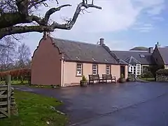 Redpath Village Hall
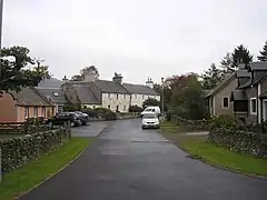 Redpath Village
.jpg.webp) Leader Water outside Redpath
Leader Water outside Redpath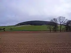 Redpath Hill
See also
References
This article is issued from Wikipedia. The text is licensed under Creative Commons - Attribution - Sharealike. Additional terms may apply for the media files.