Ray, Alabama | |
|---|---|
 Location of Ray in Coosa County, Alabama. | |
 Ray | |
| Coordinates: 32°53′14″N 86°02′16″W / 32.88722°N 86.03778°W | |
| Country | United States |
| State | Alabama |
| County | Coosa |
| Area | |
| • Total | 9.51 sq mi (24.64 km2) |
| • Land | 9.46 sq mi (24.51 km2) |
| • Water | 0.05 sq mi (0.13 km2) |
| Elevation | 732 ft (223 m) |
| Population (2020) | |
| • Total | 326 |
| • Density | 34.45/sq mi (13.30/km2) |
| Time zone | UTC-6 (Central (CST)) |
| • Summer (DST) | UTC-5 (CDT) |
| Area code(s) | 256 & 938 |
| GNIS feature ID | 125452[2] |
Ray is a census-designated place and unincorporated community in Coosa County, Alabama, United States. Its population was 326 as of the 2020 census.
Demographics
| Census | Pop. | Note | %± |
|---|---|---|---|
| 2010 | 443 | — | |
| 2020 | 326 | −26.4% | |
| U.S. Decennial Census[3] | |||
References
- ↑ "2020 U.S. Gazetteer Files". United States Census Bureau. Retrieved October 29, 2021.
- ↑ "Ray". Geographic Names Information System. United States Geological Survey, United States Department of the Interior.
- ↑ "Census of Population and Housing". Census.gov. Retrieved June 4, 2016.
Municipalities and communities of Coosa County, Alabama, United States | ||
|---|---|---|
| Towns | 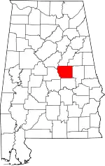 Map of Alabama highlighting Coosa County | |
| CDPs | ||
| Other unincorporated communities | ||
| Footnotes | ‡This populated place also has portions in an adjacent county or counties | |
This article is issued from Wikipedia. The text is licensed under Creative Commons - Attribution - Sharealike. Additional terms may apply for the media files.