| Rötspitze | |
|---|---|
 | |
| Highest point | |
| Elevation | 3,495 m (11,467 ft) |
| Prominence | 653[1] |
| Isolation | 5.4 km (3.4 mi) |
| Listing | Alpine mountains above 3000 m |
| Coordinates | 47°1′38″N 12°12′16″E / 47.02722°N 12.20444°E |
| Geography | |
| Location | Tyrol, Austria / South Tyrol, Italy |
| Parent range | Hohe Tauern |
| Climbing | |
| First ascent | 22 August 1854 |
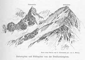
The Rötspitze (Italian: Pizzo Rosso; German: Rötspitze) is a mountain in the Hohe Tauern on the border between Tyrol, Austria, and South Tyrol, Italy.
References
- ↑ "Rötspitze - Peakbagger". Peakbagger.com. Retrieved 14 May 2020.
- Willi End: Alpenvereinsführer Venedigergruppe, München 2006, ISBN 3-7633-1242-0
- Eduard Richter, Hrsg.: Erschließung der Ostalpen, III. Band, Verlag des Deutschen und Oesterreichischen Alpenvereins, Berlin 1894
- Raimund von Klebelsberg, Innsbruck: Geologie von Tirol, Gebrüder Borntraeger, Berlin 1935
- Casa Editrice Tabacco: Carta topografica 1:25.000, Blatt 035, Valle Aurina/Ahrntal, Vedrette di Ries/Rieserferner Gruppe
External links
![]() Media related to Rötspitze at Wikimedia Commons
Media related to Rötspitze at Wikimedia Commons
This article is issued from Wikipedia. The text is licensed under Creative Commons - Attribution - Sharealike. Additional terms may apply for the media files.