Röthlein | |
|---|---|
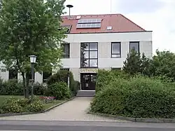 Röthlein Rathaus, or Town Hall | |
 Coat of arms | |
Location of Röthlein within Schweinfurt district  | |
 Röthlein 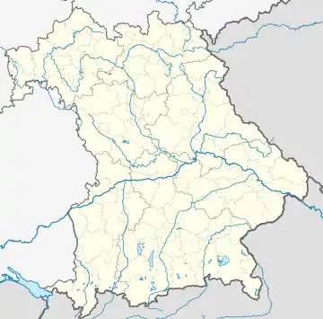 Röthlein | |
| Coordinates: 49°58′N 10°13′E / 49.967°N 10.217°E | |
| Country | Germany |
| State | Bavaria |
| Admin. region | Unterfranken |
| District | Schweinfurt |
| Subdivisions | 3 Ortsteile |
| Government | |
| • Mayor (2020–26) | Peter Gehring[1] |
| Area | |
| • Total | 19.09 km2 (7.37 sq mi) |
| Elevation | 211 m (692 ft) |
| Population (2022-12-31)[2] | |
| • Total | 4,498 |
| • Density | 240/km2 (610/sq mi) |
| Time zone | UTC+01:00 (CET) |
| • Summer (DST) | UTC+02:00 (CEST) |
| Postal codes | 97520 |
| Dialling codes | 09723 |
| Vehicle registration | SW |
| Website | www.roethlein.de |
Röthlein is a municipality in the district of Schweinfurt in Bavaria, Germany. The village is located south of Schweinfurt, close to the Main valley. The quarters are Röthlein, Heidenfeld and Hirschfeld.
References
- ↑ Liste der ersten Bürgermeister/Oberbürgermeister in kreisangehörigen Gemeinden, Bayerisches Landesamt für Statistik, 15 July 2021.
- ↑ Genesis Online-Datenbank des Bayerischen Landesamtes für Statistik Tabelle 12411-003r Fortschreibung des Bevölkerungsstandes: Gemeinden, Stichtag (Einwohnerzahlen auf Grundlage des Zensus 2011)
This article is issued from Wikipedia. The text is licensed under Creative Commons - Attribution - Sharealike. Additional terms may apply for the media files.