Réal
Ral | |
|---|---|
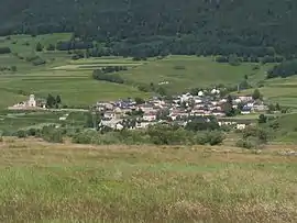 View of Réal from the Formiguères road | |
Location of Réal | |
 Réal 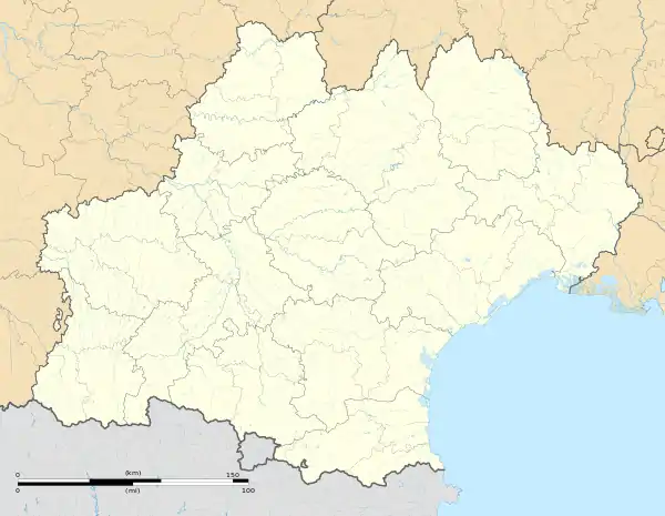 Réal | |
| Coordinates: 42°37′53″N 2°08′04″E / 42.6314°N 2.1344°E | |
| Country | France |
| Region | Occitania |
| Department | Pyrénées-Orientales |
| Arrondissement | Prades |
| Canton | Les Pyrénées catalanes |
| Intercommunality | Pyrénées Catalanes |
| Government | |
| • Mayor (2020–2026) | Jean-Luc Seguy[1] |
| Area 1 | 10.45 km2 (4.03 sq mi) |
| Population | 69 |
| • Density | 6.6/km2 (17/sq mi) |
| Time zone | UTC+01:00 (CET) |
| • Summer (DST) | UTC+02:00 (CEST) |
| INSEE/Postal code | 66159 /66210 |
| Elevation | 1,379–2,340 m (4,524–7,677 ft) (avg. 1,580 m or 5,180 ft) |
| 1 French Land Register data, which excludes lakes, ponds, glaciers > 1 km2 (0.386 sq mi or 247 acres) and river estuaries. | |
Réal (French pronunciation: [ʁeal] ⓘ; Catalan: Real) is a commune in the Pyrénées-Orientales department in southern France.
Geography
Réal is in the canton of Les Pyrénées catalanes and in the arrondissement of Prades.
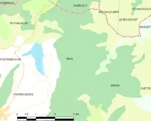
Map of Réal and its surrounding communes
Population
| Year | Pop. | ±% p.a. |
|---|---|---|
| 1968 | 71 | — |
| 1975 | 53 | −4.09% |
| 1982 | 44 | −2.62% |
| 1990 | 25 | −6.82% |
| 1999 | 31 | +2.42% |
| 2007 | 42 | +3.87% |
| 2012 | 61 | +7.75% |
| 2017 | 66 | +1.59% |
| Source: INSEE[3] | ||
Sites of interest
- The Saint-Romain church, built between the 11th and 17th centuries.
- The Puyvalador lake.
See also
References
- ↑ "Répertoire national des élus: les maires" (in French). data.gouv.fr, Plateforme ouverte des données publiques françaises. 13 September 2022.
- ↑ "Populations légales 2021". The National Institute of Statistics and Economic Studies. 28 December 2023.
- ↑ Population en historique depuis 1968, INSEE
Wikimedia Commons has media related to Réal.
This article is issued from Wikipedia. The text is licensed under Creative Commons - Attribution - Sharealike. Additional terms may apply for the media files.