| Quennell Lake | |
|---|---|
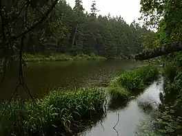 Shoreline of Quennell Lake, with the island visible across the water | |
 Quennell Lake | |
| Location | Vancouver Island, British Columbia |
| Coordinates | 49°5′N 123°49′W / 49.083°N 123.817°W |
| Basin countries | Canada |
| Surface area | 1.4 km (0.9 mi) |
| Average depth | 3.5 m (11 ft) |
| Max. depth | 6.9 m (23 ft) |
| Water volume | 4,159,000 m3 (146,900,000 cu ft) |
| Shore length1 | 14,700 m (48,200 ft) |
| Surface elevation | 33 m (108 ft) |
| Islands | 3,400 m (11,200 ft) |
| 1 Shore length is not a well-defined measure. | |
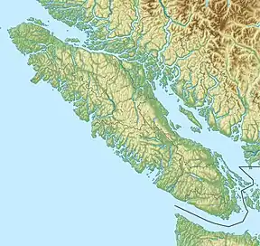
Quennell Lake is a lake located the eastern side of Vancouver Island, British Columbia, Canada. It is located between Ladysmith and Nanaimo in the area of Yellow Point.[1] The lake is used extensively for recreational activities including swimming, canoeing, and fishing.[2][3] The lake and surrounding wetlands are home to a wide range of birds and mature Douglas fir forest, and is considered a fragile ecosystem.[4][5]
See also
References
- ↑ "Quennell Lake". Canoe & Kayak Vancouver Island.
- ↑ "Quennel-Holden Water Allocation Plan" (PDF). Government of BC.
- ↑ "Quennell Lake". Anglers Atlas.
- ↑ "Quennell Lake". Ebird.
- ↑ "Terrestrial Ecosystem Map" (PDF). Government of BC.
This article is issued from Wikipedia. The text is licensed under Creative Commons - Attribution - Sharealike. Additional terms may apply for the media files.