Quelneuc
Kelenneg | |
|---|---|
Part of Carentoir | |
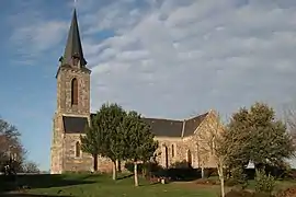 The church of Saint-François-de-Sales, in Quelneuc | |
Location of Quelneuc | |
 Quelneuc  Quelneuc | |
| Coordinates: 47°49′27″N 2°03′55″W / 47.8242°N 2.0653°W | |
| Country | France |
| Region | Brittany |
| Department | Morbihan |
| Arrondissement | Vannes |
| Canton | Guer |
| Commune | Carentoir |
| Area 1 | 13.85 km2 (5.35 sq mi) |
| Population (2019)[1] | 512 |
| • Density | 37/km2 (96/sq mi) |
| Time zone | UTC+01:00 (CET) |
| • Summer (DST) | UTC+02:00 (CEST) |
| Postal code | 56910 |
| Elevation | 7–95 m (23–312 ft) |
| 1 French Land Register data, which excludes lakes, ponds, glaciers > 1 km2 (0.386 sq mi or 247 acres) and river estuaries. | |
Quelneuc (Breton: Kelenneg) is a former commune in the Morbihan department of Brittany in north-western France.[2] On 1 January 2017, it was merged into the commune Carentoir.[3]
Demographics
Inhabitants of Quelneuc are called in French Quelneucois.
See also
References
- ↑ Téléchargement du fichier d'ensemble des populations légales en 2019, INSEE
- ↑ Des villages de Cassini aux communes d'aujourd'hui: Commune data sheet Quelneuc, EHESS (in French).
- ↑ Arrêté préfectoral 25 October 2016 (in French)
External links
Wikimedia Commons has media related to Quelneuc.
- Official website (in French)
- Base Mérimée: Search for heritage in the commune, Ministère français de la Culture. (in French)
This article is issued from Wikipedia. The text is licensed under Creative Commons - Attribution - Sharealike. Additional terms may apply for the media files.