09°09′28″S 35°17′42″W / 9.15778°S 35.29500°W Porto de Pedras is a municipality located in the northern coast of the Brazilian state of Alagoas. Its population was 7,701 in 2020.[1] Its area is 266 km².[2]
Geography
Climate
| Climate data for Porto de Pedras (1981–2010, extremes 1961–present) | |||||||||||||
|---|---|---|---|---|---|---|---|---|---|---|---|---|---|
| Month | Jan | Feb | Mar | Apr | May | Jun | Jul | Aug | Sep | Oct | Nov | Dec | Year |
| Record high °C (°F) | 32.0 (89.6) |
32.6 (90.7) |
33.4 (92.1) |
32.6 (90.7) |
31.7 (89.1) |
30.5 (86.9) |
37.1 (98.8) |
30.3 (86.5) |
37.3 (99.1) |
30.7 (87.3) |
31.2 (88.2) |
32.5 (90.5) |
37.3 (99.1) |
| Mean daily maximum °C (°F) | 30.2 (86.4) |
30.6 (87.1) |
30.5 (86.9) |
30.0 (86.0) |
29.1 (84.4) |
28.0 (82.4) |
27.4 (81.3) |
27.4 (81.3) |
28.2 (82.8) |
29.3 (84.7) |
29.9 (85.8) |
30.3 (86.5) |
29.2 (84.6) |
| Daily mean °C (°F) | 27.2 (81.0) |
27.5 (81.5) |
27.4 (81.3) |
27.1 (80.8) |
26.2 (79.2) |
25.3 (77.5) |
24.7 (76.5) |
24.6 (76.3) |
25.4 (77.7) |
26.2 (79.2) |
26.8 (80.2) |
27.1 (80.8) |
26.3 (79.3) |
| Mean daily minimum °C (°F) | 24.0 (75.2) |
24.1 (75.4) |
23.9 (75.0) |
23.7 (74.7) |
22.9 (73.2) |
22.3 (72.1) |
21.7 (71.1) |
21.6 (70.9) |
22.5 (72.5) |
23.1 (73.6) |
23.8 (74.8) |
24.0 (75.2) |
23.1 (73.6) |
| Record low °C (°F) | 18.3 (64.9) |
18.3 (64.9) |
19.4 (66.9) |
19.2 (66.6) |
17.7 (63.9) |
17.2 (63.0) |
16.1 (61.0) |
15.8 (60.4) |
17.3 (63.1) |
13.0 (55.4) |
17.2 (63.0) |
19.1 (66.4) |
13.0 (55.4) |
| Average precipitation mm (inches) | 68.2 (2.69) |
90.9 (3.58) |
201.1 (7.92) |
211.6 (8.33) |
227.6 (8.96) |
305.7 (12.04) |
240.4 (9.46) |
166.2 (6.54) |
91.9 (3.62) |
43.2 (1.70) |
32.5 (1.28) |
39.6 (1.56) |
1,718.9 (67.67) |
| Average precipitation days (≥ 1.0 mm) | 7 | 9 | 12 | 15 | 17 | 20 | 20 | 16 | 9 | 6 | 4 | 5 | 140 |
| Mean monthly sunshine hours | 282.8 | 240.3 | 256.4 | 225.2 | 213.9 | 180.2 | 185.3 | 213.9 | 246.1 | 276.0 | 291.8 | 292.7 | 2,904.6 |
| Source 1: Instituto Nacional de Meteorologia[3] | |||||||||||||
| Source 2: Meteo Climat (record highs and lows)[4] | |||||||||||||
References
- ↑ IBGE 2020
- ↑ IBGE -
- ↑ "Normais Climatológicas Do Brasil 1981–2010" (in Portuguese). Instituto Nacional de Meteorologia. Retrieved 25 October 2018.
- ↑ "Station Porto de Pedras" (in French). Meteo Climat. Retrieved 25 October 2018.
Capital: Maceió | ||
| Arapiraca | 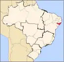 | |
| Palmeira dos Índios | ||
| Traipu | ||
| Litoral Norte Alagoano | ||
| Maceió | ||
| Mata Alagoana | ||
| Penedo | ||
| São Miguel dos Campos | ||
| Serrana dos Quilombos | ||
| Alagoana do Sertão do São Francisco | ||
| Batalha | ||
| Santana do Ipanema | ||
| Serrana do Sertão Alagoano | ||
This article is issued from Wikipedia. The text is licensed under Creative Commons - Attribution - Sharealike. Additional terms may apply for the media files.