Ponsford | |
|---|---|
 Ponsford  Ponsford | |
| Coordinates: 46°58′12″N 95°23′01″W / 46.97000°N 95.38361°W | |
| Country | United States |
| State | Minnesota |
| County | Becker |
| Elevation | 1,535 ft (468 m) |
| Time zone | UTC-6 (Central (CST)) |
| • Summer (DST) | UTC-5 (CDT) |
| Area code | 218 |
| GNIS feature ID | 649629[1] |
Ponsford (/ˈpɒnsfərd/ PONSS-fərd)[2] is an unincorporated community in Becker County, Minnesota, United States.[1] It is west of Park Rapids on former Minnesota State Highway 225.
Minnesota State Highway 34 is nearby.
References
- 1 2 "Ponsford". Geographic Names Information System. United States Geological Survey, United States Department of the Interior.
- ↑ "Minnesota Pronunciation Guide". Associated Press. Archived from the original on July 22, 2011. Retrieved July 4, 2011.
Municipalities and communities of Becker County, Minnesota, United States | ||
|---|---|---|
| Cities | 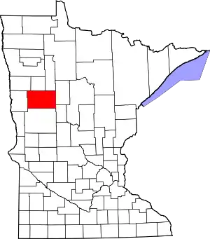 Map of Minnesota highlighting Becker County | |
| Townships |
| |
| CDPs | ||
| Unincorporated communities | ||
| Indian reservations | ||
| Footnotes | ‡This populated place also has portions in an adjacent county or counties | |
This article is issued from Wikipedia. The text is licensed under Creative Commons - Attribution - Sharealike. Additional terms may apply for the media files.