| Plover Hill | |
|---|---|
 | |
| Highest point | |
| Elevation | 680 m (2,230 ft)[1] |
| Prominence | 59 m (194 ft) |
| Parent peak | Pen-y-ghent |
| Listing | Hewitt, Nuttall |
| Coordinates | 54°10′21″N 2°13′58″W / 54.17237°N 2.23281°W |
| Geography | |
 Plover Hill | |
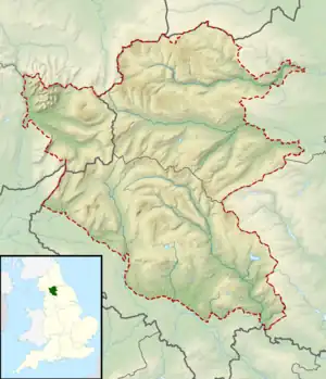
| Parent range | Yorkshire Dales |
| OS grid | SD849752 |
| Topo map | OS Explorer OL2 |
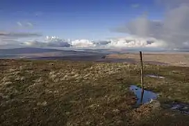
Plover Hill is an area of moorland lying to the north of Pen-y-ghent in the Yorkshire Dales and connected to it by an unbroken area of high ground. Whilst the whole area is now "open access land",[2] the main right-of-way footpaths come directly from the north off Foxup Road and directly from the south from the summit of Pen-y-ghent.
Plover Hill rises between two side valleys of Littondale: the valley of Hesleden Beck to the south and that of Foxup Beck to the north. It lies within the civil parish of Halton Gill.
References
- ↑ Alan Dawson (1992). "The absolute summits of England and Wales". Relative Hills of Britain. Cicerone Press. pp. 206–229. ISBN 978-1-85284-068-6.
- ↑ "Rights of way and accessing land" - official Government site
External links
![]() Media related to Plover Hill at Wikimedia Commons
Media related to Plover Hill at Wikimedia Commons
This article is issued from Wikipedia. The text is licensed under Creative Commons - Attribution - Sharealike. Additional terms may apply for the media files.