Pimenteiras do Oeste | |
|---|---|
 | |
 Flag  Coat of arms | |
 Location in Rondônia state | |
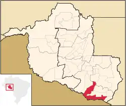
 Pimenteiras do Oeste Location in Brazil | |
| Coordinates: 13°28′57″S 61°2′48″W / 13.48250°S 61.04667°W | |
| Country | Brazil |
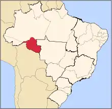
| Region | North |
| State | Rondônia |
| Area | |
| • Total | 6,015 km2 (2,322 sq mi) |
| Elevation | 185 m (607 ft) |
| Population (2020 [1]) | |
| • Total | 2,148 |
| • Density | 0.36/km2 (0.92/sq mi) |
| Time zone | UTC−4 (AMT) |
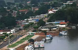
Pimenteiras do Oeste is a municipality located in the Brazilian state of Rondônia. Its population was 2,148 (2020) and its area is 6,015 km2.[2]
The municipality contains 52% of the 384,055 hectares (949,020 acres) Corumbiara State Park, created in 1990.[3]
References
Capital: Porto Velho | ||||||||
| Porto Velho |
|  | ||||||
| Ji-Paraná |
| |||||||
This article is issued from Wikipedia. The text is licensed under Creative Commons - Attribution - Sharealike. Additional terms may apply for the media files.