Pike, Indiana | |
|---|---|
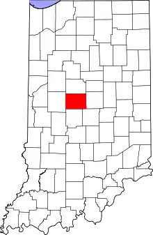 Boone County's location in Indiana | |
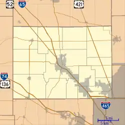 Pike Location in Boone County | |
| Coordinates: 40°07′27″N 86°28′55″W / 40.12417°N 86.48194°W | |
| Country | United States |
| State | Indiana |
| County | Boone |
| Township | Washington |
| Elevation | 915 ft (279 m) |
| Time zone | UTC-5 (Eastern (EST)) |
| • Summer (DST) | UTC-4 (EDT) |
| ZIP code | 46052 |
| Area code | 765 |
| FIPS code | 18-59706[2] |
| GNIS feature ID | 441127 |
Pike is an unincorporated community in Washington Township, Boone County, in the U.S. state of Indiana.[3]
History
The first post office at Pike was called Pikes Crossing, in 1885.[4] It was so named from its location at the crossing of a turnpike.[5] The post office was later renamed Pike, and was discontinued in 1900.[6]
Geography
Pike is located at 40°07′27″N 86°28′55″W / 40.12417°N 86.48194°W.
References
- ↑ "US Board on Geographic Names". United States Geological Survey. October 25, 2007. Retrieved January 31, 2008.
- ↑ "U.S. Census website". United States Census Bureau. Retrieved January 31, 2008.
- ↑ "Pike, Indiana". Geographic Names Information System. United States Geological Survey. Retrieved March 6, 2020.
- ↑ Baker, Ronald L. (October 1995). From Needmore to Prosperity: Hoosier Place Names in Folklore and History. Indiana University Press. p. 263. ISBN 978-0-253-32866-3.
A post office established as Pikes Crossing...
- ↑ Early Life and Times in Boone County, Indiana. Carlon & Hollenbeck. 1887. p. 35.
- ↑ "Boone County". Jim Forte Postal History. Retrieved August 26, 2014.
Municipalities and communities of Boone County, Indiana, United States | ||
|---|---|---|
| City | Map of Indiana highlighting Boone County | |
| Towns | ||
| Townships | ||
| CDP | ||
| Other communities | ||
| Footnotes | ‡This populated place also has portions in an adjacent county or counties | |
This article is issued from Wikipedia. The text is licensed under Creative Commons - Attribution - Sharealike. Additional terms may apply for the media files.