Pfarrweisach | |
|---|---|
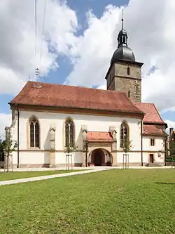 Church of Saint Kilian | |
 Coat of arms | |
Location of Pfarrweisach within Haßberge district 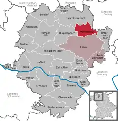 | |
 Pfarrweisach 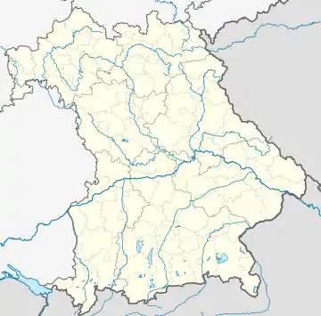 Pfarrweisach | |
| Coordinates: 50°09′N 10°44′E / 50.150°N 10.733°E | |
| Country | Germany |
| State | Bavaria |
| Admin. region | Unterfranken |
| District | Haßberge |
| Municipal assoc. | Ebern |
| Government | |
| • Mayor (2020–26) | Markus Oppelt[1] (CSU) |
| Area | |
| • Total | 28.43 km2 (10.98 sq mi) |
| Elevation | 285 m (935 ft) |
| Population (2022-12-31)[2] | |
| • Total | 1,492 |
| • Density | 52/km2 (140/sq mi) |
| Time zone | UTC+01:00 (CET) |
| • Summer (DST) | UTC+02:00 (CEST) |
| Postal codes | 96176 |
| Dialling codes | 09535 |
| Vehicle registration | HAS |
| Website | www.pfarrweisach.de |
Pfarrweisach is a municipality in the district of Haßberge in Bavaria in Germany.
Geography
Location
Pfarrweisach lies in the Main-Rhön Region (Bavarian planning region no. 3).
Subdivisions
Pfarrweisach is divided into nine sub-municipalities (population in brackets as at: 5 January 2009):[3]
|
|
Neighbouring municipalities
Its neighbouring municipalities (clockwise from the north) are: Maroldsweisach, Seßlach, Untermerzbach, Ebern and Burgpreppach.
References
- ↑ Liste der ersten Bürgermeister/Oberbürgermeister in kreisangehörigen Gemeinden, Bayerisches Landesamt für Statistik, 15 July 2021.
- ↑ Genesis Online-Datenbank des Bayerischen Landesamtes für Statistik Tabelle 12411-003r Fortschreibung des Bevölkerungsstandes: Gemeinden, Stichtag (Einwohnerzahlen auf Grundlage des Zensus 2011)
- ↑ "Bayerische Landesbibliothek Online (BLO)".
Towns and municipalities in Haßberge (district) | ||
|---|---|---|
Coat of Arms of Haßberge district | ||
This article is issued from Wikipedia. The text is licensed under Creative Commons - Attribution - Sharealike. Additional terms may apply for the media files.