Patterson, Georgia | |
|---|---|
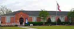 Patterson City Hall | |
 Location in Pierce County and the state of Georgia | |
| Coordinates: 31°23′14″N 82°8′18″W / 31.38722°N 82.13833°W | |
| Country | United States |
| State | Georgia |
| County | Pierce |
| Area | |
| • Total | 2.65 sq mi (6.86 km2) |
| • Land | 2.64 sq mi (6.83 km2) |
| • Water | 0.01 sq mi (0.02 km2) |
| Elevation | 105 ft (32 m) |
| Population (2020) | |
| • Total | 749 |
| • Density | 283.82/sq mi (109.59/km2) |
| Time zone | UTC-5 (Eastern (EST)) |
| • Summer (DST) | UTC-4 (EDT) |
| ZIP code | 31557 |
| Area code | 912 |
| FIPS code | 13-59500[2] |
| GNIS feature ID | 0332619[3] |
| Website | thecityofpatterson |
Patterson is a city in Pierce County, Georgia, United States. The population was 749 in 2020.
History
Patterson was named after William Paterson, the proprietor of a local sawmill.[4] The Georgia General Assembly incorporated Patterson in 1893.[5]
Geography
Patterson is located at 31°23′14″N 82°08′18″W / 31.387356°N 82.138281°W.[6] According to the United States Census Bureau, the city has a total area of 2.7 square miles (7.0 km2), all land.
Climate
| Climate data for Patterson, Georgia | |||||||||||||
|---|---|---|---|---|---|---|---|---|---|---|---|---|---|
| Month | Jan | Feb | Mar | Apr | May | Jun | Jul | Aug | Sep | Oct | Nov | Dec | Year |
| Mean daily maximum °C (°F) | 17 (63) |
19 (66) |
21 (70) |
26 (78) |
29 (85) |
32 (90) |
33 (92) |
33 (92) |
31 (87) |
26 (79) |
21 (69) |
17 (62) |
26 (78) |
| Mean daily minimum °C (°F) | 4 (39) |
3 (38) |
7 (44) |
11 (51) |
16 (60) |
20 (68) |
21 (70) |
22 (71) |
19 (67) |
13 (56) |
7 (44) |
3 (38) |
12 (54) |
| Average precipitation mm (inches) | 110 (4.2) |
97 (3.8) |
110 (4.3) |
86 (3.4) |
94 (3.7) |
140 (5.5) |
150 (6.1) |
140 (5.7) |
99 (3.9) |
79 (3.1) |
58 (2.3) |
71 (2.8) |
220 (8.7) |
| Source: Weatherbase [7] | |||||||||||||
Demographics
| Census | Pop. | Note | %± |
|---|---|---|---|
| 1900 | 314 | — | |
| 1910 | 264 | −15.9% | |
| 1920 | 357 | 35.2% | |
| 1930 | 528 | 47.9% | |
| 1940 | 541 | 2.5% | |
| 1950 | 656 | 21.3% | |
| 1960 | 719 | 9.6% | |
| 1970 | 788 | 9.6% | |
| 1980 | 763 | −3.2% | |
| 1990 | 626 | −18.0% | |
| 2000 | 627 | 0.2% | |
| 2010 | 730 | 16.4% | |
| 2020 | 749 | 2.6% | |
| U.S. Decennial Census[8] | |||
| Race | Num. | Perc. |
|---|---|---|
| White (non-Hispanic) | 601 | 80.24% |
| Black or African American (non-Hispanic) | 99 | 13.22% |
| Asian | 2 | 0.27% |
| Other/Mixed | 23 | 3.07% |
| Hispanic or Latino | 24 | 3.2% |
As of the 2020 United States census, there were 749 people, 311 households, and 168 families residing in the city.
Notable people
- KaDee Strickland, actress (b. 1975) Born in Blackshear but she grew up in Patterson and went to school in Pierce County. Her successful acting career includes a starring role in the television series Private Practice.
- Lindsay Thomas, Congressman born in Patterson.[10]
References
- ↑ "2020 U.S. Gazetteer Files". United States Census Bureau. Retrieved December 18, 2021.
- ↑ "U.S. Census website". United States Census Bureau. Retrieved January 31, 2008.
- ↑ "US Board on Geographic Names". United States Geological Survey. October 25, 2007. Retrieved January 31, 2008.
- ↑ Krakow, Kenneth K. (1975). Georgia Place-Names: Their History and Origins (PDF). Macon, GA: Winship Press. p. 172. ISBN 0-915430-00-2.
- ↑ Acts of the General Assembly of the State of Georgia. Clark & Hines, State Printers. 1893. p. 284.
- ↑ "US Gazetteer files: 2010, 2000, and 1990". United States Census Bureau. February 12, 2011. Retrieved April 23, 2011.
- ↑ "Weatherbase.com". Weatherbase. 2013. Retrieved on September 28, 2013.
- ↑ "Census of Population and Housing". Census.gov. Retrieved June 4, 2015.
- ↑ "Explore Census Data". data.census.gov. Retrieved December 18, 2021.
- ↑ Robert Lindsay Thomas at Biographical Directory of the United States Congress
Municipalities and communities of Pierce County, Georgia, United States | ||
|---|---|---|
| Cities | 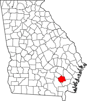 Map of Georgia highlighting Pierce County | |
| CDPs | ||
| Other communities | ||
| Ghost town | ||
This article is issued from Wikipedia. The text is licensed under Creative Commons - Attribution - Sharealike. Additional terms may apply for the media files.