Palfau | |
|---|---|
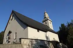 Palfau parish church | |
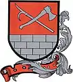 Coat of arms | |
 Palfau Location within Austria | |
| Coordinates: 47°42′35″N 14°48′15″E / 47.70972°N 14.80417°E | |
| Country | Austria |
| State | Styria |
| District | Liezen |
| Government | |
| • Mayor | Franz Danner (SPÖ) |
| Area | |
| • Total | 58.07 km2 (22.42 sq mi) |
| Elevation | 512 m (1,680 ft) |
| Population (1 January 2016)[1] | |
| • Total | 394 |
| • Density | 6.8/km2 (18/sq mi) |
| Time zone | UTC+1 (CET) |
| • Summer (DST) | UTC+2 (CEST) |
| Postal code | 8923 |
| Area code | 03638 |
| Vehicle registration | LI |
| Website | www.palfau.at |
Palfau is a former municipality in the district of Liezen in the Austrian state of Styria. Since the 2015 Styria municipal structural reform, it is part of the municipality Landl.[2]
Population
| Year | Pop. | ±% |
|---|---|---|
| 1869 | 655 | — |
| 1880 | 659 | +0.6% |
| 1890 | 637 | −3.3% |
| 1900 | 618 | −3.0% |
| 1910 | 595 | −3.7% |
| 1923 | 560 | −5.9% |
| 1934 | 540 | −3.6% |
| 1939 | 536 | −0.7% |
| 1951 | 543 | +1.3% |
| 1961 | 512 | −5.7% |
| 1971 | 508 | −0.8% |
| 1981 | 512 | +0.8% |
| 1991 | 519 | +1.4% |
| 2001 | 449 | −13.5% |
| 2011 | 405 | −9.8% |
References
This article is issued from Wikipedia. The text is licensed under Creative Commons - Attribution - Sharealike. Additional terms may apply for the media files.