Ouarville | |
|---|---|
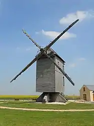 The windmill in Ouarville | |
 Coat of arms | |
Location of Ouarville | |
 Ouarville 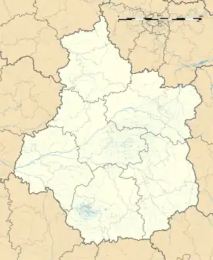 Ouarville | |
| Coordinates: 48°21′17″N 1°46′30″E / 48.3547°N 1.775°E | |
| Country | France |
| Region | Centre-Val de Loire |
| Department | Eure-et-Loir |
| Arrondissement | Chartres |
| Canton | Les Villages Vovéens |
| Government | |
| • Mayor (2020–2026) | Jean-Michel Dubief[1] |
| Area 1 | 20.13 km2 (7.77 sq mi) |
| Population | 519 |
| • Density | 26/km2 (67/sq mi) |
| Time zone | UTC+01:00 (CET) |
| • Summer (DST) | UTC+02:00 (CEST) |
| INSEE/Postal code | 28291 /28150 |
| Elevation | 146–154 m (479–505 ft) (avg. 150 m or 490 ft) |
| 1 French Land Register data, which excludes lakes, ponds, glaciers > 1 km2 (0.386 sq mi or 247 acres) and river estuaries. | |
Ouarville (French pronunciation: [waʁvil]) is a commune in the Eure-et-Loir department in northern France.
Population
| Year | Pop. | ±% p.a. |
|---|---|---|
| 1968 | 425 | — |
| 1975 | 408 | −0.58% |
| 1982 | 425 | +0.58% |
| 1990 | 468 | +1.21% |
| 1999 | 549 | +1.79% |
| 2007 | 574 | +0.56% |
| 2012 | 544 | −1.07% |
| 2017 | 524 | −0.75% |
| Source: INSEE[3] | ||
See also
References
- ↑ "Répertoire national des élus: les maires" (in French). data.gouv.fr, Plateforme ouverte des données publiques françaises. 4 May 2022.
- ↑ "Populations légales 2021". The National Institute of Statistics and Economic Studies. 28 December 2023.
- ↑ Population en historique depuis 1968, INSEE
Wikimedia Commons has media related to Ouarville.
This article is issued from Wikipedia. The text is licensed under Creative Commons - Attribution - Sharealike. Additional terms may apply for the media files.