Omar, Delaware | |
|---|---|
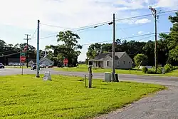 Intersection of Delaware Route 20 and Omar Road in Omar | |
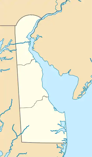 Omar, Delaware Location within the state of Delaware  Omar, Delaware Omar, Delaware (the United States) | |
| Coordinates: 38°31′38″N 75°11′59″W / 38.52722°N 75.19972°W | |
| Country | United States |
| State | Delaware |
| County | Sussex |
| Time zone | UTC-5 (Eastern (EST)) |
| • Summer (DST) | UTC-4 (EDT) |
| GNIS feature ID | 216170[1] |
Omar is an unincorporated community in Sussex County, Delaware, United States, located at the crossroads of Delaware Route 20 (Armory Road/Pyle Center Road) and Sussex County Road 54 (Omar Road) and between the towns of Dagsboro and Roxana.[1]
Omar was a post village.[2]
The Baltimore Mills Historic Archaeological Site was added to the National Register of Historic Places in 1997.[3]
References
- 1 2 "Omar". Geographic Names Information System. United States Geological Survey, United States Department of the Interior.
- ↑ Gannett, Henry (1904), A Gazetteer of Delaware (Issue 230 of Geological Survey bulletin), U.S. Government Printing Office
- ↑ "National Register Information System". National Register of Historic Places. National Park Service. July 9, 2010.
Municipalities and communities of Sussex County, Delaware, United States | ||
|---|---|---|
| Cities | Map of Delaware highlighting Sussex County | |
| Towns | ||
| CDPs | ||
| Former towns | ||
| Unincorporated communities |
| |
| Hundreds | ||
| Ghost towns | ||
| Footnotes | ‡This populated place also has portions in an adjacent county or counties | |
This article is issued from Wikipedia. The text is licensed under Creative Commons - Attribution - Sharealike. Additional terms may apply for the media files.