Oberdolling | |
|---|---|
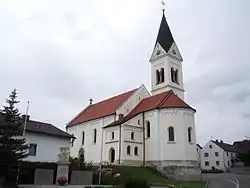 Church of Saint George | |
 Coat of arms | |
Location of Oberdolling within Eichstätt district 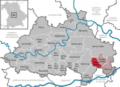 | |
 Oberdolling 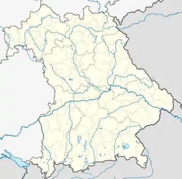 Oberdolling | |
| Coordinates: 48°50′N 11°35′E / 48.833°N 11.583°E | |
| Country | Germany |
| State | Bavaria |
| Admin. region | Oberbayern |
| District | Eichstätt |
| Municipal assoc. | Pförring |
| Subdivisions | 6 Ortsteile |
| Government | |
| • Mayor (2020–26) | Josef Lohr[1] (CSU) |
| Area | |
| • Total | 19.37 km2 (7.48 sq mi) |
| Elevation | 382 m (1,253 ft) |
| Population (2022-12-31)[2] | |
| • Total | 1,342 |
| • Density | 69/km2 (180/sq mi) |
| Time zone | UTC+01:00 (CET) |
| • Summer (DST) | UTC+02:00 (CEST) |
| Postal codes | 85129 |
| Dialling codes | 08404 |
| Vehicle registration | EI |
| Website | www.oberdolling.de |
Oberdolling is a municipality in the district of Eichstätt in Bavaria in Germany.
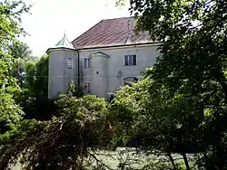
Water castle Oberdolling
References
- ↑ Liste der ersten Bürgermeister/Oberbürgermeister in kreisangehörigen Gemeinden, Bayerisches Landesamt für Statistik, accessed 19 July 2021.
- ↑ Genesis Online-Datenbank des Bayerischen Landesamtes für Statistik Tabelle 12411-003r Fortschreibung des Bevölkerungsstandes: Gemeinden, Stichtag (Einwohnerzahlen auf Grundlage des Zensus 2011)
Wikimedia Commons has media related to Oberdolling.
Towns and municipalities in Eichstätt (district) | ||
|---|---|---|
| Coat of Arms of Eichstätt district | |
This article is issued from Wikipedia. The text is licensed under Creative Commons - Attribution - Sharealike. Additional terms may apply for the media files.