| Musa | |
|---|---|
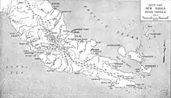 The Musa River is on the east coast, south of the latitude of Port Morsby and just north of Cape Nelson. | |
| Location | |
| Country | Papua New Guinea |
| Region | Gulf |
| Physical characteristics | |
| Source | |
| • location | Papua New Guinea |
| Mouth | |
• location | Gulf of Papua, Papua New Guinea |
| Basin size | 4,813 km2 (1,858 sq mi) |
| Discharge | |
| • average | 319 m3/s (11,300 cu ft/s) |
| • minimum | 76 m3/s (2,700 cu ft/s) |
| • maximum | 618 m3/s (21,800 cu ft/s) |
The Musa is a river on the eastern side of the Papuan Peninsula, in Papua New Guinea. It is one of the primary rivers on Oro Province. Its mouth exits into Dyke Ackland Bay.[1]
A plan to dam the river in 1975 caused local opposition.[2]
References
- ↑ Murray, J.H.P. Papua; or British New Guinea, pp. 107-08 (1912)
- ↑ May, R.J. State and Society in Papua New Guinea: The First Twenty-Five Years, p. 64-65 (2001)
- Smith, John Wallis; Green, David Headley (1961). The Geology of the Musa River Area, Papua. Australia Bureau of Mineral Resources, Geology and Geophysics.
9°03′S 148°55′E / 9.050°S 148.917°E
This article is issued from Wikipedia. The text is licensed under Creative Commons - Attribution - Sharealike. Additional terms may apply for the media files.