| Moyer Creek | |
|---|---|
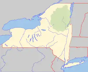 Location of the mouth of Moyer Creek  Moyer Creek (the United States) | |
| Location | |
| Country | United States |
| State | New York |
| Physical characteristics | |
| Source | Wheelock Pond |
| • location | Jerusalem Hill, New York |
| Mouth | Mohawk River |
• location | Frankfort, New York |
• coordinates | 43°02′37″N 75°04′10″W / 43.04361°N 75.06944°W |
• elevation | 385 ft (117 m) |
| Basin size | 20.2 sq mi (52 km2) |
| Basin features | |
| Tributaries | |
| • left | Black Creek |
Moyer Creek starts at Wheelock Pond near Jerusalem Hill, New York. Past Gulph, New York Moyer Creek follows a deep ravine, the Frankfort Gorge, south towards Frankfort, New York before converging with the Mohawk River in Frankfort, New York.[1] The headwaters of Moyer Creek rise within a half mile of the source of the Unadilla River which is the most northerly headwater source of the Susquehanna and the closest to the Mohawk River.[2]
References
- ↑ "Moyer Creek". usgs.gov. United States Geological Survey. Retrieved April 18, 2017.
- ↑ "Frankfort". scenectadyhistory.org. Schenectady history. Retrieved April 21, 2017.
This article is issued from Wikipedia. The text is licensed under Creative Commons - Attribution - Sharealike. Additional terms may apply for the media files.