Morningside, New Mexico | |
|---|---|
 Morningside | |
| Coordinates: 32°51′40″N 104°23′49″W / 32.86111°N 104.39694°W | |
| Country | United States |
| State | New Mexico |
| County | Eddy |
| Area | |
| • Total | 0.09 sq mi (0.24 km2) |
| • Land | 0.09 sq mi (0.24 km2) |
| • Water | 0.00 sq mi (0.00 km2) |
| Elevation | 3,373 ft (1,028 m) |
| Population | |
| • Total | 302 |
| • Density | 3,212.77/sq mi (1,242.53/km2) |
| Time zone | UTC-7 (Mountain (MST)) |
| • Summer (DST) | UTC-6 (MDT) |
| Area code | 575 |
| GNIS feature ID | 2584157[2] |
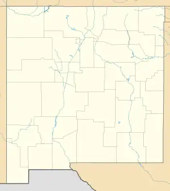
Morningside is an unincorporated community and census-designated place in Eddy County, New Mexico, United States. Its population was 367 as of the 2010 census.[4] The community is located on the northern border of Artesia west of U.S. Route 285.
Geography
Morningside is located along US Route 285 just north of Artesia.[2] According to the U.S. Census Bureau, the community has an area of 0.090 square miles (0.23 km2), all land.[4]
Demographics
| Census | Pop. | Note | %± |
|---|---|---|---|
| 2020 | 302 | — | |
| U.S. Decennial Census[5][3] | |||
Education
It is within the Artesia Public Schools school district.[6] Artesia High School is the school district's sole comprehensive high school.
References
- ↑ "ArcGIS REST Services Directory". United States Census Bureau. Retrieved October 12, 2022.
- 1 2 3 U.S. Geological Survey Geographic Names Information System: Morningside, New Mexico
- 1 2 "Census Population API". United States Census Bureau. Retrieved October 12, 2022.
- 1 2 "2010 Census Gazetteer Files - Places: New Mexico". U.S. Census Bureau. Retrieved December 7, 2015.
- ↑ "Census of Population and Housing". Census.gov. Retrieved June 4, 2016.
- ↑ "2020 CENSUS - SCHOOL DISTRICT REFERENCE MAP: Eddy County, NM" (PDF). U.S. Census Bureau. Retrieved June 28, 2022. - Text list
Municipalities and communities of Eddy County, New Mexico, United States | ||
|---|---|---|
| Cities | 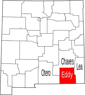 Map of New Mexico highlighting Eddy County | |
| Villages | ||
| CDPs | ||
| Unincorporated communities | ||
This article is issued from Wikipedia. The text is licensed under Creative Commons - Attribution - Sharealike. Additional terms may apply for the media files.