Mombaroccio | |
|---|---|
| Comune di Mombaroccio | |
 | |
 Coat of arms | |
Location of Mombaroccio | |
 Mombaroccio Location of Mombaroccio in Italy 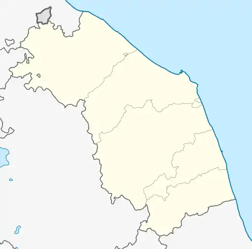 Mombaroccio Mombaroccio (Marche) | |
| Coordinates: 43°48′N 12°51′E / 43.800°N 12.850°E | |
| Country | Italy |
| Region | Marche |
| Province | Pesaro e Urbino (PU) |
| Frazioni | Montegiano, Villagrande |
| Government | |
| • Mayor | Emanuele Petrucci |
| Area | |
| • Total | 28.2 km2 (10.9 sq mi) |
| Elevation | 321 m (1,053 ft) |
| Population (31 October 2020)[2] | |
| • Total | 2,055 |
| • Density | 73/km2 (190/sq mi) |
| Demonym | Mombaroccesi |
| Time zone | UTC+1 (CET) |
| • Summer (DST) | UTC+2 (CEST) |
| Postal code | 61024 |
| Dialing code | 0721 |
| Patron saint | St. Vitus and Modestus |
| Saint day | 15 June |
| Website | Official website |
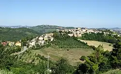
Mombaroccio is a comune (municipality) in the Province of Pesaro e Urbino in the Italian region Marche, located about 60 kilometres (37 mi) northwest of Ancona and about 14 kilometres (9 mi) southwest of Pesaro.
References
- ↑ "Superficie di Comuni Province e Regioni italiane al 9 ottobre 2011". Italian National Institute of Statistics. Retrieved 16 March 2019.
- ↑ All demographics and other statistics: Italian statistical institute Istat.
This article is issued from Wikipedia. The text is licensed under Creative Commons - Attribution - Sharealike. Additional terms may apply for the media files.