| Millfore | |
|---|---|
 | |
| Highest point | |
| Elevation | 657 m (2,156 ft)[1] |
| Prominence | 250 m (820 ft)[2] |
| Listing | Ma,Hu,Tu,Sim,G,D,DN,Y[3] |
| Coordinates | 55°03′01″N 4°23′01″W / 55.0504°N 4.3836°W |
| Naming | |
| English translation | Scottish Gaelic: Cold, Round Hill |
| Geography | |
| Location | Dumfries and Galloway, Scotland |
| Parent range | Minnigaff Hills, Galloway Hills, Southern Uplands |
| OS grid | NX 47812 75455 |
| Topo map | OS Landranger 77 |
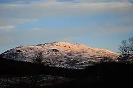
Millfore is a hill in the Minnigaff Hills, a sub-range of the Galloway Hills range, part of the Southern Uplands of Scotland. It lies northeast of Newton Stewart in Galloway Forest Park, Dumfries and Galloway. One of the less-visited of the Galloway Hills, it nonetheless provides excellent views from its summit over its neighbours and Loch Dee.[4] Isolated from its westerly neighbours by the White Laggan glen, it is frequently climbed on its own from Clatteringshaws Loch to the east.[5]
References
- ↑ "Millfore".
- ↑ "Millfore".
- ↑ "Database of British and Irish Hills: User guide".
- ↑ "Walkinghighlands Millfore". walkinghighlands.co.uk. Retrieved 23 October 2019.
- ↑ "Millfore".
This article is issued from Wikipedia. The text is licensed under Creative Commons - Attribution - Sharealike. Additional terms may apply for the media files.