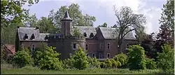
Meeuwen-Gruitrode
Miëve-Roy | |
|---|---|
Village | |
 | |
 Flag  Seal | |
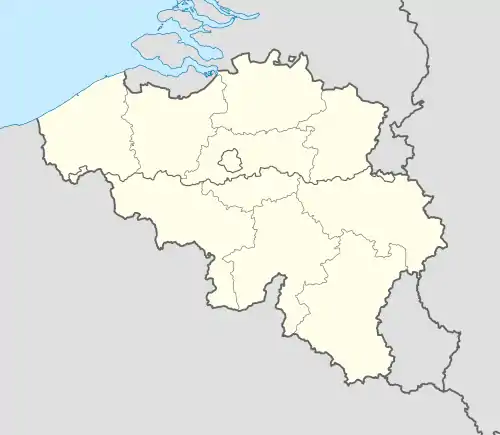 Meeuwen-Gruitrode Location in Belgium | |
| Coordinates: 51°06′N 05°31′E / 51.100°N 5.517°E | |
| Country | |
| Region | Flemish Region |
| Province | Limburg |
| Municipality | Oudsbergen |
| Area | |
| • Total | 91.31 km2 (35.25 sq mi) |
| Population (2021)[1] | |
| • Total | 13,117 |
| • Density | 140/km2 (370/sq mi) |
| Time zone | CET |
| Website | www.meeuwen-gruitrode.be |
Meeuwen-Gruitrode (Dutch pronunciation: [ˌmeːu.ə(ŋ)ˈɣrœytˌroːdə]; Limburgish: Miëve-Roj, [ˈmiəvəˈʀɔj]) is a former municipality located in the Belgian province of Limburg. In 2021, Meeuwen-Gruitrode had a total population of 13,117. The total area is 91.31 km².
The municipality consisted of the following sub-municipalities: Meeuwen, Gruitrode, Ellikom, Neerglabbeek, and Wijshagen. It also includes the hamlets of Muisven, Ophoven, Zoetebeek, Koestraat, and Plokrooi.
Effective 1 January 2019, Opglabbeek and Meeuwen-Gruitrode were merged into the new municipality of Oudsbergen.
References
- 1 2 "Bevolking per statistische sector - Sector 72040". Statistics Belgium. Retrieved 12 May 2022.
External links
 Media related to Meeuwen-Gruitrode at Wikimedia Commons
Places adjacent to Meeuwen-Gruitrode | ||||||||||||||||
|---|---|---|---|---|---|---|---|---|---|---|---|---|---|---|---|---|
| ||||||||||||||||
This article is issued from Wikipedia. The text is licensed under Creative Commons - Attribution - Sharealike. Additional terms may apply for the media files.