Marhof | |
|---|---|
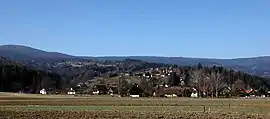 Marhof | |
 Coat of arms | |
 Marhof Location within Austria | |
| Coordinates: 46°54′00″N 15°13′00″E / 46.90000°N 15.21667°E | |
| Country | Austria |
| State | Styria |
| District | Deutschlandsberg |
| Area | |
| • Total | 30.80 km2 (11.89 sq mi) |
| Elevation | 460 m (1,510 ft) |
| Population (1 January 2016)[1] | |
| • Total | 1,047 |
| • Density | 34/km2 (88/sq mi) |
| Time zone | UTC+1 (CET) |
| • Summer (DST) | UTC+2 (CEST) |
| Postal code | 8510 |
| Area code | +43 3463 |
| Vehicle registration | DL |
Marhof is a former municipality in the district of Deutschlandsberg in the Austrian state of Styria. Since the 2015 Styria municipal structural reform, it is part of the municipality Stainz.[2]
Population
| Year | Pop. | ±% |
|---|---|---|
| 1869 | 1,141 | — |
| 1880 | 1,164 | +2.0% |
| 1890 | 1,273 | +9.4% |
| 1900 | 1,143 | −10.2% |
| 1910 | 1,164 | +1.8% |
| 1923 | 1,077 | −7.5% |
| 1934 | 1,200 | +11.4% |
| 1939 | 1,193 | −0.6% |
| 1951 | 1,186 | −0.6% |
| 1961 | 1,092 | −7.9% |
| 1971 | 1,164 | +6.6% |
| 1981 | 1,119 | −3.9% |
| 1991 | 1,074 | −4.0% |
| 2001 | 1,063 | −1.0% |
| 2011 | 1,013 | −4.7% |
References
This article is issued from Wikipedia. The text is licensed under Creative Commons - Attribution - Sharealike. Additional terms may apply for the media files.