| Madeleine | |
|---|---|
 | |
  | |
| Location | |
| Country | France |
| Physical characteristics | |
| Mouth | |
• location | Bourbeuse |
• coordinates | 47°35′36″N 6°58′29″E / 47.59333°N 6.97472°E |
• elevation | 340 m (1,120 ft) |
| Length | 25 km (16 mi) |
| Basin size | 92 km2 (36 sq mi) |
| Basin features | |
| Progression | Bourbeuse→ Allan→ Doubs→ Saône→ Rhône→ Mediterranean Sea |
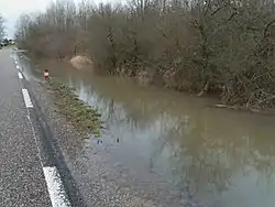
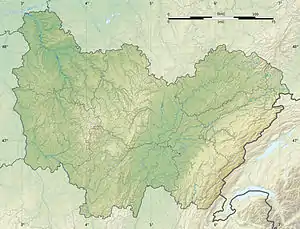
The Madeleine is a river in north eastern France, in the Territoire de Belfort département. It is 25.4 km long,[1] and its basin area is 92 km².
It begins in the Vosges mountains, near the commune of Lamadeleine-Val-des-Anges. It joins the river Saint-Nicolas in the village Bretagne at 340 m above sea level to form the river Bourbeuse. The river Bourbeuse is a tributary to the river Allan, which is a tributary to the river Doubs.
The Madeleine river flows through the communes of Étueffont, Anjoutey, Bourg-sous-Châtelet, Bethonvilliers, Lacollonge, Fontenelle, Petit-Croix and Novillard.
It is also a fishing area. The confluence with the Saint-Nicolas is in a marshy area.
References
This article is issued from Wikipedia. The text is licensed under Creative Commons - Attribution - Sharealike. Additional terms may apply for the media files.