| Llanbadarn Fynydd | |
|---|---|
 | |
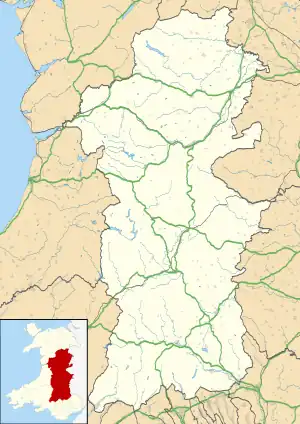 Llanbadarn Fynydd Location within Powys | |
| Population | 306 |
| OS grid reference | SO 0980 7775 |
| • Cardiff | 63.2 mi (101.7 km) |
| • London | 149.3 mi (240.3 km) |
| Community |
|
| Principal area | |
| Country | Wales |
| Sovereign state | United Kingdom |
| Post town | Llandrindod Wells |
| Postcode district | LD1 |
| Police | Dyfed-Powys |
| Fire | Mid and West Wales |
| Ambulance | Welsh |
| UK Parliament | |
| Senedd Cymru – Welsh Parliament | |
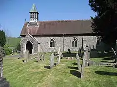
Llanbadarn Fynydd (meaning Church of Padarn in the mountain)[1] is a village and community in Radnorshire, Powys, Wales, and is 63 miles (101 km) from Cardiff and 149 miles (240 km) from London.[2]
The community includes the villages of Llanbadarn Fynydd, Llananno and Llaithddu. In 2011 the population of Llanbadarn Fynydd was 306 with 8.8% of them able to speak Welsh.[3]
Castell y Blaidd Medieval Settlement lies nearby as well as Coventry Round Barrow and Moel Dod Round Barrow.
The New Inn is a former 17th-century coaching inn, now a family-run pub and restaurant.[4]
It lies on the A483 road which runs from Swansea to Chester.
See also
References
- ↑ "Historic Settlements Survey - Radnorshire - Llanbadarn Fynydd" (PDF). Clwyd Powys Archaeological Trust. Retrieved 8 February 2018.
- ↑ Fynydd Bangor University Placenames Unit (Canolfan Bedwyr); Archived 23 September 2015 at the Wayback Machine accessed 9 May 2014
- ↑ Welsh Government website; 2011 Census Returns and stats; Archived 30 May 2014 at the Wayback Machine accessed 9 May 2014
- ↑ "The New Inn, Country Pub and Restaurant Llanbadarn Fynydd". New Inn. Retrieved 6 December 2016.
Wikimedia Commons has media related to Llanbadarn Fynydd.
This article is issued from Wikipedia. The text is licensed under Creative Commons - Attribution - Sharealike. Additional terms may apply for the media files.