Liebenau | |
|---|---|
 | |
 Coat of arms | |
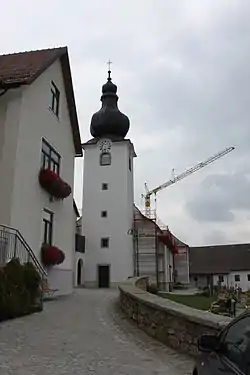
 Liebenau Location within Austria | |
| Coordinates: 48°31′50″N 14°48′20″E / 48.53056°N 14.80556°E | |
| Country | Austria |
| State | Upper Austria |
| District | Freistadt |
| Government | |
| • Mayor | Erich Punz (SPÖ) |
| Area | |
| • Total | 76.26 km2 (29.44 sq mi) |
| Elevation | 970 m (3,180 ft) |
| Population (2018-01-01)[2] | |
| • Total | 1,597 |
| • Density | 21/km2 (54/sq mi) |
| Time zone | UTC+1 (CET) |
| • Summer (DST) | UTC+2 (CEST) |
| Postal code | 4252 |
| Area code | 07953 |
| Vehicle registration | FR |
| Website | www.liebenau.at |
Liebenau is a municipality in the district of Freistadt in the Austrian state of Upper Austria.
Localities
- Eibenberg
- Geierschlag
- Glashütten
- Hirschau
- Kienau
- Komau
- Leopoldstein
- Liebenstein
- Maxldorf
- Monegg
- Neustift
- Reitern
- Schanz
- Schöneben
- Windhagmühl
Population
| Year | Pop. | ±% |
|---|---|---|
| 1869 | 2,154 | — |
| 1880 | 2,313 | +7.4% |
| 1890 | 2,398 | +3.7% |
| 1900 | 2,345 | −2.2% |
| 1910 | 2,378 | +1.4% |
| 1923 | 2,352 | −1.1% |
| 1934 | 2,496 | +6.1% |
| 1939 | 2,415 | −3.2% |
| 1951 | 2,256 | −6.6% |
| 1961 | 2,314 | +2.6% |
| 1971 | 2,249 | −2.8% |
| 1981 | 2,108 | −6.3% |
| 1991 | 1,957 | −7.2% |
| 2001 | 1,840 | −6.0% |
References
- ↑ "Dauersiedlungsraum der Gemeinden Politischen Bezirke und Bundesländer - Gebietsstand 1.1.2018". Statistics Austria. Retrieved 10 March 2019.
- ↑ "Einwohnerzahl 1.1.2018 nach Gemeinden mit Status, Gebietsstand 1.1.2018". Statistics Austria. Retrieved 9 March 2019.
Wikimedia Commons has media related to Liebenau, Upper Austria.
This article is issued from Wikipedia. The text is licensed under Creative Commons - Attribution - Sharealike. Additional terms may apply for the media files.