Laussa | |
|---|---|
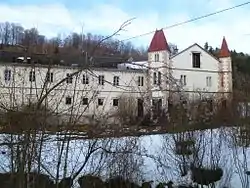 Kogl palace | |
 Coat of arms | |
 Laussa Location within Austria | |
| Coordinates: 47°57′01″N 14°27′02″E / 47.95028°N 14.45056°E | |
| Country | Austria |
| State | Upper Austria |
| District | Steyr-Land |
| Government | |
| • Mayor | Josef Gsöllpointner (ÖVP) |
| Area | |
| • Total | 34.31 km2 (13.25 sq mi) |
| Elevation | 431 m (1,414 ft) |
| Population (2018-01-01)[2] | |
| • Total | 1,227 |
| • Density | 36/km2 (93/sq mi) |
| Time zone | UTC+1 (CET) |
| • Summer (DST) | UTC+2 (CEST) |
| Postal code | 4461 |
| Area code | 07255 |
| Vehicle registration | SE |
| Website | www.laussa.at |
Laussa is a municipality in the district of Steyr-Land in the Austrian state of Upper Austria.
Geography
Laussa lies in the Traunviertel. About 36 percent of the municipality is forest, and 58 percent is farmland.
References
- ↑ "Dauersiedlungsraum der Gemeinden Politischen Bezirke und Bundesländer - Gebietsstand 1.1.2018". Statistics Austria. Retrieved 10 March 2019.
- ↑ "Einwohnerzahl 1.1.2018 nach Gemeinden mit Status, Gebietsstand 1.1.2018". Statistics Austria. Retrieved 9 March 2019.
Wikimedia Commons has media related to Laussa.
This article is issued from Wikipedia. The text is licensed under Creative Commons - Attribution - Sharealike. Additional terms may apply for the media files.