Lamari Rural LLG | |
|---|---|
 Lamari Rural LLG Location within Papua New Guinea | |
| Coordinates: 6°33′04″S 145°58′33″E / 6.551098°S 145.975956°E | |
| Country | Papua New Guinea |
| Province | Eastern Highlands Province |
| Time zone | UTC+10 (AEST) |
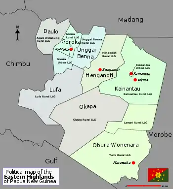
District map of Eastern Highlands Province
Lamari Rural LLG is a local-level government (LLG) of Eastern Highlands Province, Papua New Guinea.[1][2]
Wards
- 01. Motokara
- 02. Kobara
- 03. Atagara
- 04. Numbaira
- 05. Bibeori
- 06. Baira No. 2
- 07. Baira No. 1
- 08. Mei'auna
- 09. Ogurataba
- 10. Bi'api'arata
- 11. Bakumpa
- 12. Kawaina No. 1
- 13. Kumbora
- 14. Saurona
- 15. Obura Gov't Station
- 16. Kurunumbura
- 17. Yunura
- 18. Asara
- 19. Himarata
- 20. Anima
- 21. Tunana
- 22. Ahea
- 23. Habi ina
- 24. Oraura No. 1
- 25. Kokombira
- 26. Pinata
- 27. Owena
- 28. Tainoraba
- 29. Mobutasa
- 30. Agamusi
References
- ↑ "Census Figures by Wards - Highlands Region". www.nso.gov.pg. 2011 National Population and Housing Census: Ward Population Profile. Port Moresby: National Statistical Office, Papua New Guinea. 2014.
- ↑ "Final Figures". www.nso.gov.pg. 2011 National Population and Housing Census: Ward Population Profile. Port Moresby: National Statistical Office, Papua New Guinea. 2014.
- OCHA FISS (2018). "Papua New Guinea administrative level 0, 1, 2, and 3 population statistics and gazetteer". Humanitarian Data Exchange. 1.31.9.
- United Nations in Papua New Guinea (2018). "Papua New Guinea Village Coordinates Lookup". Humanitarian Data Exchange. 1.31.9.
| Daulo District | ||
|---|---|---|
| Goroka District | ||
| Henganofi District | ||
| Kainantu District | ||
| Lufa District | ||
| Obura-Wonenara District | ||
| Okapa District | ||
This article is issued from Wikipedia. The text is licensed under Creative Commons - Attribution - Sharealike. Additional terms may apply for the media files.