Lahstedt | |
|---|---|
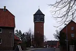 Water tower | |
 Coat of arms | |
Location of Lahstedt | |
 Lahstedt 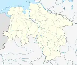 Lahstedt | |
| Coordinates: 52°15′N 10°13′E / 52.250°N 10.217°E | |
| Country | Germany |
| State | Lower Saxony |
| District | Peine |
| Disbanded | 2015 |
| Subdivisions | 5 Ortsteile |
| Area | |
| • Total | 43.6 km2 (16.8 sq mi) |
| Elevation | 97 m (318 ft) |
| Population (2013-12-31) | |
| • Total | 9,985 |
| • Density | 230/km2 (590/sq mi) |
| Time zone | UTC+01:00 (CET) |
| • Summer (DST) | UTC+02:00 (CEST) |
| Postal codes | 31246 |
| Dialling codes | 05172, 05174 |
| Vehicle registration | PE |
| Website | www.lahstedt.de |
Lahstedt is a former municipality in the district of Peine, in Lower Saxony, Germany. It was situated approximately 11 km south of Peine, and 20 km west of Braunschweig.
Lahstedt was formed on 1 February 1971 by merging the five villages of Adenstedt, Gadenstedt, Groß Lafferde, Münstedt and Oberg.[1] "Lahstedt" itself was an artificial name, but not a population centre. Since 1 January 2015 its subdivisions are part of the municipality Ilsede.[2]
Municipal subdivisions
- Adenstedt
- Gadenstedt
- Groß Lafferde
- Münstedt
- Oberg
References
External links
![]() Media related to Lahstedt at Wikimedia Commons
Media related to Lahstedt at Wikimedia Commons
This article is issued from Wikipedia. The text is licensed under Creative Commons - Attribution - Sharealike. Additional terms may apply for the media files.