| Lac des Bouillouses Llac de la Bollosa | |
|---|---|
.jpg.webp) | |
 Lac des Bouillouses Llac de la Bollosa | |
| Location | Pyrénées-Orientales |
| Coordinates | 42°34′13″N 1°59′58″E / 42.570225°N 1.999426°E |
| Type | reservoir |
| Primary outflows | Têt |
| Basin countries | France |
| Surface area | 1.49 km2 (0.58 sq mi) |
| Max. depth | 25 m (82 ft) |
| Water volume | 17,500,000 m3 (620,000,000 cu ft) |
| Surface elevation | 2,017 m (6,617 ft) |
Lac des Bouillouses or Llac de la Bollosa is a lake in Pyrénées-Orientales, France. At an elevation of 2017 m, its surface area is 1.49 km².[1]
It is an artificial lake, the 20-metre high dam of which was built between 1903 and 1910 as a key part of a hydro-electricity project in the Têt valley.[2]
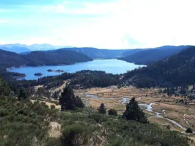 The lake is fed by River Têt (below, on the right).
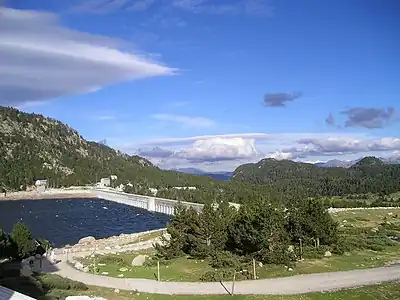 The dam at the southern end of the lake.
References
- ↑ Topographical map extract (in Géoportail).
- ↑ "Les Bouillouses", on les-pyrenees-orientales.com (in French).
This article is issued from Wikipedia. The text is licensed under Creative Commons - Attribution - Sharealike. Additional terms may apply for the media files.