Kurwar
Kurwār, Kurwāl | |
|---|---|
Village | |
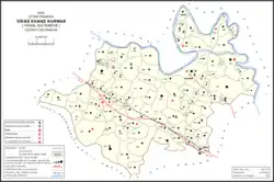 Map showing Kurwar (#785) in Kurwar CD block | |
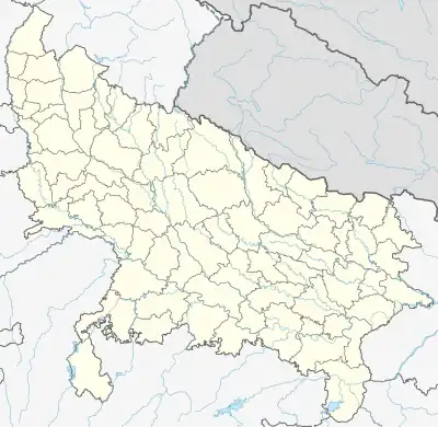 Kurwar Location in Uttar Pradesh, India | |
| Coordinates: 26°20′51″N 81°58′43″E / 26.347496°N 81.97874°E[1] | |
| Country | |
| State | Uttar Pradesh |
| Division | Faizabad division |
| District | Sultanpur |
| Area | |
| • Total | 6.718 km2 (2.594 sq mi) |
| Population (2011)[2] | |
| • Total | 10,826 |
| • Density | 1,600/km2 (4,200/sq mi) |
| Languages | |
| • Official | Hindi, Urdu |
| Time zone | UTC+5:30 (IST) |
Kurwar is a village and community development block headquarters in Sultanpur tehsil of Sultanpur district, Uttar Pradesh, India.[2] It is located by the Gomti River, 14 km northwest of Sultanpur on the road to Isauli and Haliapur.[3] The southern part of the village is on fairly high ground, but the area north of the main road is low-lying and prone to flooding.[3] Kurwar historically was the seat of the taluqdari estate of the Raja of Kurwar, who was the head of the Bachgoti Rajput clan.[3]
As of 2011, Kurwar has a population of 10,826, in 1,785 households.[2] It has 4 primary schools and a community health centre.[2] Kurwar hosts a market twice per week, on Mondays and Fridays; it mostly deals in cloth, pottery and bullocks.[4] It also hosts a large Dussehra festival involving dramatic reenactments of scenes from the Ramayana.[4] Vendors bring items such as earthenware pottery, hosiery, hemp ropes, cloth, toys, and sweets to sell at the fair.[4] Kurwar is also the seat of a nyaya panchayat which also includes 13 other villages.[5]
History
Kurwar was historically the seat of the Raja of Kurwar, who was head of the Bachgoti Rajput clan and who lived in a palace here.[3] The palace was built by the Court of Wards, and Raja Partab Bahadur Singh also built a large zanana house which was completed in 1902.[3]
The Rajas of Kurwar claimed descent from one Prithipat Singh; the ninth raja, Niwaz Singh, had two sons named Lachhman Singh (who inherited Kurwar) and Man Singh (who received the taluqa of Bhiti; Lachhman Singh's grandsons all died without issue, and Sukhdev Singh, a descendant of Man Singh, seized Kurwar, and his descendants would subsequently reign as rajas.[3] At the turn of the 20th century, the Kurwar estate consisted of 64 villages and 9 pattis in the parganas of Miranpur and Baraunsa, and the raja also held the Hathgaon estate of 37 villages and 15 pattis in Faizabad district.[3]
At the turn of the 20th century, Kurwar was described as a large village with "a very flourishing upper primary school, one of the best in the district," as well as a female dispensary maintained by the Raja of Kurwar.[3] It was not, however a trade centre.[3] The population as of 1901 was 3,004 people, including 2,297 Hindus and 707 Muslims.[3] The main caste groups were Brahmins, Thakurs, and Kayasths.[3]
The 1951 census recorded Kurwar as comprising 36 hamlets, with a total population of 3,640 people (1,808 male and 1,832 female), in 852 households and 780 physical houses.[6] The area of the village was given as 1,722 acres.[6] The village was listed as belonging to the pargana of Miranpur and the thana of Kotwali.[6] The village had a district board-run primary school with 276 students in attendance as of 1 January 1951.[6]
The 1961 census recorded Kurwar as comprising 37 hamlets, with a total population of 4,112 people (2,047 male and 2,065 female), in 795 households and 760 physical houses.[4] The area of the village was given as 1,722 acres and it had a medical practitioner, maternity and child welfare centre, and government-run dispensary with 2 male and 2 female beds.[4] Average attendance of the twice-weekly haat was about 1,500 people, while attendance of the Dussehra fair was about 2,000.[4]
The 1981 census recorded Kurwar as having a population of 5,876 people, in 1,031 households, and having an area of 696.89 hectares.[7] The main staple foods were listed as wheat and rice.[7]
The 1991 census recorded Kurwar (as "Kudwar") as having a total population of 7,428 people (3,826 male and 3,602 female), in 1,181 households and 1,156 physical houses.[5] The area of the village was listed as 996.89 hectares.[5] Members of the 0-6 age group numbered 1,426, or 19% of the total; this group was 53% male (757) and 47% female (669).[5] Members of scheduled castes numbered 758, or 10% of the village's total population, while no members of scheduled tribes were recorded.[5] The literacy rate of the village was 52% (2,152 men and 984 women, counting only people age 7 and up).[5] 1,970 people were classified as main workers (1,736 men and 234 women), while 10 people were classified as marginal workers (all women); the remaining 5,448 residents were non-workers.[5] The breakdown of main workers by employment category was as follows: 635 cultivators (i.e. people who owned or leased their own land); 530 agricultural labourers (i.e. people who worked someone else's land in return for payment); 0 workers in livestock, forestry, fishing, hunting, plantations, orchards, etc.; 0 in mining and quarrying; 188 household industry workers; 70 workers employed in other manufacturing, processing, service, and repair roles; 4 construction workers; 245 employed in trade and commerce; 23 employed in transport, storage, and communications; and 285 in other services.[5]
Villages
Kurwar CD block has the following 99 villages:[2]
| Village name | Total land area (hectares) | Population (in 2011) |
|---|---|---|
| Basantpur Tivaripur | 135.5 | 1,489 |
| Khajapur | 77.6 | 645 |
| Marha | 176.8 | 1,027 |
| Madhopur Acharya | 77.8 | 1,426 |
| Bahubara | 209.8 | 1,885 |
| Agai | 421.9 | 3,371 |
| Mudva | 321.5 | 2,948 |
| Avadha | 88 | 285 |
| Sarav | 128.6 | 1,195 |
| Soti | 49 | 34 |
| Madhopur | 82.3 | 375 |
| Nougbatir | 491.3 | 2,821 |
| Uapadh Yaypur | 38.9 | 359 |
| Pratappur | 341.7 | 2,148 |
| Bhandar Parasrampur | 1,318.5 | 5,656 |
| Tirachha | 25.8 | 700 |
| Nirsahiya | 229.8 | 1,505 |
| Kumhai | 171.9 | 905 |
| Sohgouli | 645.1 | 6,339 |
| Bhagvanpur | 50.4 | 818 |
| Utmanpur | 61.6 | 551 |
| Gajahati | 154.7 | 3,905 |
| Bhdahara | 136.4 | 1,422 |
| Khadar Basantpur | 283.6 | 1,454 |
| Nayora | 92.2 | 859 |
| Kurwar (block headquarters) | 671.8 | 10,826 |
| Isauli | 98.5 | 1,349 |
| Devalpur | 191.7 | 1,631 |
| Chitaipur | 51.9 | 845 |
| Harkhpur | 157.7 | 2,310 |
| Grantkurvar | 328 | 1,101 |
| Dhanrava | 389 | 7,354 |
| Sarkoura | 464.9 | 4,849 |
| Kapurpur | 70 | 65 |
| Jagdishpur | 59 | 719 |
| Pataipur | 115.6 | 826 |
| Mahmudpur Bangir | 29 | 387 |
| Pipri | 227.3 | 1,478 |
| Purejrekhi | 152.8 | 584 |
| Mithnepur | 171.1 | 2,011 |
| Pahrauli | 199.2 | 810 |
| Kota | 431.6 | 2,143 |
| Vinaykpur | 272.7 | 1,492 |
| Balapashchim | 473.2 | 3,807 |
| Pureudayram | 78.1 | 346 |
| Narottampur | 49.6 | 403 |
| Maviya | 77.9 | 1,249 |
| Chak Mavaiya | 14.6 | 229 |
| Kotiya | 348.1 | 5,861 |
| Purepavar | 110.2 | 896 |
| Rajapur | 205.1 | 2,521 |
| Domanpur | 358.6 | 4,814 |
| Rampur Matha | 155.4 | 1,228 |
| Dhusyariya | 225.8 | 1,530 |
| Uchgaon | 424.3 | 4,036 |
| Khadsa | 55.3 | 1,242 |
| Sarayapurevishan | 312.9 | 3,651 |
| Masetva | 55.2 | 1,042 |
| Maniyari | 191.4 | 2,931 |
| Tikariya | 259.9 | 1,270 |
| Baburi | 269.8 | 2,461 |
| Ajiyavardabi | 212 | 917 |
| Sanibhar | 179.1 | 253 |
| Majhna | 728.8 | 3,352 |
| Senduri | 68.3 | 917 |
| Daudpatti | 251.7 | 3,672 |
| Devalpur | 151.5 | 1,023 |
| Hajipatti | 654.2 | 5,777 |
| Karamchandpur | 163.9 | 881 |
| Bukunpur | 83.7 | 1,337 |
| Rampur | 136.5 | 1,359 |
| Dharupur | 230.2 | 1,552 |
| Bhati | 475.2 | 3,729 |
| Shanichara | 201.6 | 1,158 |
| Narahi | 461.9 | 3,021 |
| Shahpur Sarkande Dih | 597.9 | 5,990 |
| Pureladaie | 78.5 | 893 |
| Bahmarpur | 296.4 | 2,438 |
| Uttar Gaaon | 129 | 848 |
| Harkhi Purbiripur | 111.1 | 1,017 |
| Badauliya | 33.5 | 401 |
| Khokhipur | 295.5 | 3,042 |
| Khaniya Pashchim | 311.8 | 2,225 |
| Bahlolour | 192.3 | 2,253 |
| Khaniyapurva | 388.4 | 3,382 |
| Surjipur | 170.3 | 1,619 |
| Asaroga | 97.2 | 1,248 |
| Naaugva | 289.1 | 2,888 |
| Miranpur | 176.6 | 2,277 |
| Parsipur | 139.1 | 1,662 |
| Ajhuie | 500.7 | 4,265 |
| Kotva | 89.3 | 1,288 |
| Rankedih | 236.7 | 3,462 |
| Mudainavada | 135.1 | 1,442 |
| Bramhjitpur | 60.7 | 979 |
| Pratap Pur | 73.6 | 1,173 |
| Mahamud Pur | 73 | 515 |
| Maniyar Pur | 248.6 | 3,593 |
| Judupur | 135.1 | 2,213 |
| Block total | 203,850 | 22,516 |
| Village name | Total land area (hectares) | Population (in 2011) |
Schools
- Pragya Academy Nursery School
- RDL Public School
- BP Inter College
- Bhuvneshwari Pratap Sanskrit Maha Vidyalaya
- Dr. Mahadevi Verma Inter College
References
- ↑ "Geonames Search". Do a radial search using these coordinates here.
- 1 2 3 4 5 6 "Census of India 2011: Uttar Pradesh District Census Handbook – Sultanpur, Part A (Village and Town Directory)" (PDF). Census 2011 India. pp. 318–35. Retrieved 1 December 2021.
- 1 2 3 4 5 6 7 8 9 10 11 Nevill, H.R. (1903). Sultanpur: A Gazetteer, Being Volume XLVI Of The District Gazetteers Of The United Provinces Of Agra And Oudh. Allahabad: Government Press. pp. 94, 191, 195–6. Retrieved 1 December 2021.
- 1 2 3 4 5 6 Census 1961: District Census Handbook, Uttar Pradesh (44 – Sultanpur District) (PDF). Lucknow. 1965. pp. 121–2, 144–5, 148, lxxiv–lxxv. Retrieved 1 December 2021.
{{cite book}}: CS1 maint: location missing publisher (link) - 1 2 3 4 5 6 7 8 Census 1991 Series-25 Uttar Pradesh Part-XII B Village & Townwise Primary Census Abstract District Census Handbook District Raebareli (PDF). 1992. pp. xxiv–xxviii, 230–1. Retrieved 1 December 2021.
- 1 2 3 4 Census of India, 1951: District Census Handbook Uttar Pradesh (49 – Rae Bareli District) (PDF). Allahabad. 1955. pp. 148–9, 199. Retrieved 1 December 2021.
{{cite book}}: CS1 maint: location missing publisher (link) - 1 2 Census 1981 Uttar Pradesh: District Census Handbook Part XIII-A: Village & Town Directory, District Rae Bareli (PDF). 1982. pp. 166–7. Retrieved 1 December 2021.