Krumegg | |
|---|---|
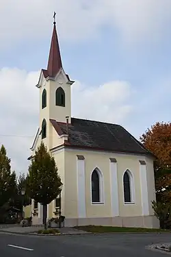 Krumegg chapel | |
 Coat of arms | |
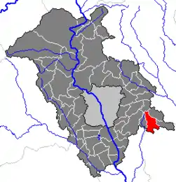 Location within Graz-Umgebung district | |
 Krumegg Location within Austria | |
| Coordinates: 47°01′13″N 15°38′02″E / 47.02028°N 15.63389°E | |
| Country | Austria |
| State | Styria |
| District | Graz-Umgebung |
| Government | |
| • Mayor | Josef Hierzer (GL) |
| Area | |
| • Total | 16.19 km2 (6.25 sq mi) |
| Elevation | 463 m (1,519 ft) |
| Population (1 January 2016)[1] | |
| • Total | 1,450 |
| • Density | 90/km2 (230/sq mi) |
| Time zone | UTC+1 (CET) |
| • Summer (DST) | UTC+2 (CEST) |
| Postal code | 8323, 8301 |
| Area code | 03133, 03119 |
| Vehicle registration | GU |
| Website | www.krumegg. steiermark.at |
Krumegg is a former municipality in the district of Graz-Umgebung in the Austrian state of Styria. Since the 2015 Styria municipal structural reform, it is part of the municipality Sankt Marein bei Graz.[2]
Geography
Krumegg lies about 15 km east of Graz in the east Styrian hills.
Subdivisions
Katastralgemeinden are Brunn, Dornegg, Kocheregg, Hohenegg, Prüfing, Kohldorf, Pirkwiesen, and Krumegg-Ort.
References
Neighboring municipalities | |
|---|---|
This article is issued from Wikipedia. The text is licensed under Creative Commons - Attribution - Sharealike. Additional terms may apply for the media files.