Kronprinzenkoog | |
|---|---|
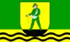 Flag  Coat of arms | |
Location of Kronprinzenkoog within Dithmarschen district 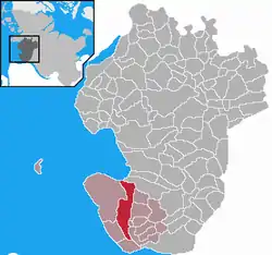 | |
 Kronprinzenkoog 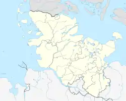 Kronprinzenkoog | |
| Coordinates: 53°58′N 8°58′E / 53.967°N 8.967°E | |
| Country | Germany |
| State | Schleswig-Holstein |
| District | Dithmarschen |
| Municipal assoc. | Marne-Nordsee |
| Government | |
| • Mayor | Georg Huesmann (CDU) |
| Area | |
| • Total | 28.85 km2 (11.14 sq mi) |
| Elevation | 0 m (0 ft) |
| Population (2022-12-31)[1] | |
| • Total | 844 |
| • Density | 29/km2 (76/sq mi) |
| Time zone | UTC+01:00 (CET) |
| • Summer (DST) | UTC+02:00 (CEST) |
| Postal codes | 25709 |
| Dialling codes | 04856, 04857 und 04851 |
| Vehicle registration | HEI |
| Website | www.amt-marne-nordsee.de |
Kronprinzenkoog is a municipality in the district of Dithmarschen, in Schleswig-Holstein, Germany.
Between 1785 and 1787, the polder (German: Koog) was laid out and then named in honour of Crown Prince Frederick of Denmark.
References
This article is issued from Wikipedia. The text is licensed under Creative Commons - Attribution - Sharealike. Additional terms may apply for the media files.