Krokava | |
|---|---|
Village | |
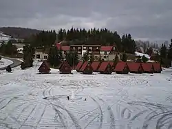 | |
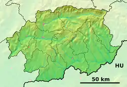 Krokava Location of Krokava in the Banská Bystrica Region 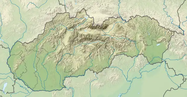 Krokava Location of Krokava in Slovakia | |
| Coordinates: 48°38′N 20°02′E / 48.633°N 20.033°E | |
| Country | |
| Region | Banská Bystrica |
| District | Rimavská Sobota |
| First mentioned | 1427 |
| Area | |
| • Total | 10.40[1] km2 (4.02[1] sq mi) |
| Elevation | 787[2] m (2,582[2] ft) |
| Population (2021) | |
| • Total | 20[3] |
| Time zone | UTC+1 (CET) |
| • Summer (DST) | UTC+2 (CEST) |
| Postal code | 982 67[2] |
| Area code | +421 47[2] |
| Car plate | RS |
| Website | www.krokava.sk/ |
Krokava (Hungarian: Kopárhegy) is a village and municipality in the Rimavská Sobota District of the Banská Bystrica Region of southern Slovakia. Originally a shepherd settlement, locals later engaged in raising cattle and weaving. One of the most notable attractions of Krokava is the village belfry.
References
- 1 2 "Hustota obyvateľstva - obce [om7014rr_ukaz: Rozloha (Štvorcový meter)]". www.statistics.sk (in Slovak). Statistical Office of the Slovak Republic. 2022-03-31. Retrieved 2022-03-31.
- 1 2 3 4 "Základná charakteristika". www.statistics.sk (in Slovak). Statistical Office of the Slovak Republic. 2015-04-17. Retrieved 2022-03-31.
- ↑ "Počet obyvateľov podľa pohlavia - obce (ročne)". www.statistics.sk (in Slovak). Statistical Office of the Slovak Republic. 2022-03-31. Retrieved 2022-03-31.
External links
 Media related to Krokava at Wikimedia Commons
- Official website

- https://web.archive.org/web/20160803222630/http://krokava.e-obce.sk/
This article is issued from Wikipedia. The text is licensed under Creative Commons - Attribution - Sharealike. Additional terms may apply for the media files.