| Kojata | |
|---|---|
 | |
| Location | |
| Country | Kyrgyzstan |
| Physical characteristics | |
| Mouth | Kara-Suu |
• coordinates | 41°39′50″N 72°02′57″E / 41.6638°N 72.0492°E |
| Length | 18 km (11 mi) |
| Basin size | 280 km2 (110 sq mi) |
| Basin features | |
| Progression | Kara-Suu→ Naryn→ Syr Darya→ North Aral Sea |
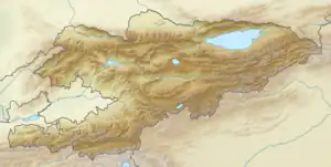
The Kojata (Kyrgyz: Кожата) is a right tributary of the Kara-Suu in Jalal-Abad Region, Kyrgyzstan. Its source is in the Chatkal Range, western Tian Shan mountains, and is fed by the Toskool, which flows out of Lake Sary-Chelek. It is 18 km long and has a drainage basin of 280 km2.[1] It discharges into the Kara-Suu near Kyzyl-Tuu.[2]
References
This article is issued from Wikipedia. The text is licensed under Creative Commons - Attribution - Sharealike. Additional terms may apply for the media files.