Kintampo District | |
|---|---|
Former District | |
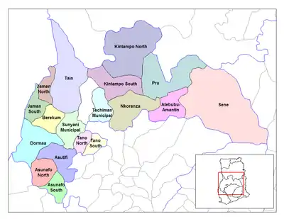 Districts of Brong-Ahafo Region | |
 Kintampo District Location of Kintampo District within Brong-Ahafo | |
| Coordinates: 8°3′8″N 1°44′5″W / 8.05222°N 1.73472°W | |
| Country | |
| Region | |
| Capital | Kintampo |
| Area | |
| • Total | 6,566 km2 (2,535 sq mi) |
| Population (2012) | |
| • Total | — |
| Time zone | UTC+0 (GMT) |
Kintampo District is a former district that was located in Brong-Ahafo Region (now currently in Bono East Region), Ghana.[1] Originally created as an ordinary district assembly on 10 March 1989. However on 12 November 2003 (effectively 17 February 2004), it was split off into two new districts: Kintampo North District (which it was elevated to municipal district assembly status on 1 November 2007 (effectively 29 February 2008); capital: Kintampo) and Kintampo South District (capital: Jema). The district assembly was located in the southern part of Brong-Ahafo Region (now western part of Bono East Region) and had Kintampo as its capital town.
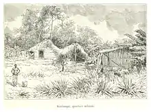
Bono quarter, Kintampo, in 1892
Sources
- "Kintampo District". Statoids.
- District: Kintampo District
- 19 New Districts Created Archived 2011-02-02 at the Wayback Machine, November 20, 2003.
References
- ↑ Bureau, Communications. ""Bono East Officially Created; Techiman Is Capital" – President Akufo-Addo". Presidency Of Ghana. Retrieved 2020-08-13.
This article is issued from Wikipedia. The text is licensed under Creative Commons - Attribution - Sharealike. Additional terms may apply for the media files.